
I dig what snowforecast.com is saying about the upcoming events
"Early November is starting to look relentless, cold and snowy all across the west"
Results 7,076 to 7,100 of 42790
-
10-28-2011, 02:37 PM #7076
 Not Remote Working
- Join Date
- Mar 2010
- Posts
- 2,682
-
10-28-2011, 03:07 PM #7077
Registered User
- Join Date
- Mar 2009
- Location
- Boulder
- Posts
- 490
Good point, though we're still so far away that I bet the storm comes in a bit slower and further west than the model's think. Even though the European pegged this last storm, the storm in real life was still further south than the model thought. I would imagine that trend continues. Here's a comparison of the ECMWF and GFS: http://www.coloradopowderforecast.co...iday-10282011/ Originally Posted by skiingislife

And here's the site to bookmark, if you're into medium-ish range weather prediction:
http://www.met.sjsu.edu/weather/mode..._500c-ani.htmlThe artist formerly known as Colorado Powder Forecast: http://www.opensnow.com
-
10-29-2011, 11:07 AM #7078
Registered User
- Join Date
- Mar 2009
- Location
- Boulder
- Posts
- 490
Looks like another powder day on Wednesday and perhaps next Friday as well. Wednesday's storm is similar to last Wednesday's storm, but there will be some differences. Too early to figure out details, but should be another good storm for a lot of the state even if amounts are slightly less.
Snowforecast.com is correct in that early November appears generally stormy in the west, but "the west" is a pretty big area. The first 10 days of the month could have storms every few days, but waaaaay too early to tell which states and areas will be the big winners. It's not too early to get excited, however.The artist formerly known as Colorado Powder Forecast: http://www.opensnow.com
-
10-31-2011, 10:14 AM #7079
Registered User
- Join Date
- Mar 2009
- Location
- Boulder
- Posts
- 490
Ok, now looks like powder mornings Wed AM and Sat AM. Sat AM could be really nice, while this Wednesday's storm will be OK, but likely about 50-75% of what happened last week. http://www.coloradopowderforecast.co...nday-10312011/
The artist formerly known as Colorado Powder Forecast: http://www.opensnow.com
-
10-31-2011, 01:37 PM #7080
 ~~~(oYo)~~~
- Join Date
- Feb 2005
- Posts
- 19,791
Good luck on your new venture Joel. Thanks for CPF and your insight here over the last couple of seasons.
-
11-01-2011, 04:43 PM #7081
 Registered Nutcase
- Join Date
- Sep 2010
- Location
- Golden, Colorado
- Posts
- 5,879
Ok, so looking at the SNOTEL observations (SnoHt), through CAIC, Berthoud is reading 4, while Loveland Basin is reading 15. For last week's storm, the numbers seemed reasonable, but the discrepency for this storm doesn't make any sense to me. Anyone who watches this stuff more than me care to educate me as to what is going on here? I had assumed these were rolling 24hr totals...
I also seem to remember seeing reasonably "accurate" information last year, as well, but shit, that was a long time ago, so maybe I was using different SNOTEL numbers/data then? I believe I was looking at the hourly precip data and converting to approx. snow accumulation, but the hourly precip data doesn't look right this year?
-
11-01-2011, 09:36 PM #7082
 Skiing Kayaker
- Join Date
- Dec 2010
- Location
- Boulder, CO
- Posts
- 58
Gonna miss CPF, now I have to get used to OpenSnow.com. Its nice to see CPF expand as demand for awesome forecasts increases.
-
11-01-2011, 10:00 PM #7083

 Registered User
- Join Date
- Apr 2004
- Location
- Three-O-Three
- Posts
- 15,674
NOAA.com's point forecast works pretty well too.
-
11-01-2011, 10:31 PM #7084
 recovering never nude
- Join Date
- Feb 2004
- Posts
- 3,746
If I'm understanding your question... Originally Posted by Lindahl
The 4 and 15 are the current snow depth measurements. Does not indicate total or 24 hour accumulation.
You can use the other parameters to get a good idea of new storm accumulations (as well as other stats).I french kissed Kelly Kapowski.
-
11-02-2011, 02:00 AM #7085
Registered User
- Join Date
- Mar 2009
- Location
- Boulder
- Posts
- 490
There are three main data points you see on the SNOTEL site: SWE, Depth, and YTD Precip. The SWE is snow water equivalent, basically you take the snow on the ground and melt it, and that's the number. This is calculated by a displacement pillow - it measures the weight/density of the snow sitting on the pillow and figures out how much water is in the snowpack. The "pillow" is basically a big rubber ball with antifreeze inside. Depth is the depth of the snow on the ground, measured by a small electronic ultrasound device. And YTD precip is the total amount of precipitation (snow and ra-n) that falls since October 1st (the start of the "water year"). I am rather amazing to see Loveland's snow depth 4x higher than Berthoud with about the same amount of YTD precip. Maybe better shading of the SNOTEL site??
First day of Opensnow went really well. Some growing pains, server bugs, and the realization that we need to simplify a lot of the site. But overall a pretty good day #1. The LiveSnow feature (http://opensnow.com/livesnow) is going to be super cool, and was somewhat inspired by all the great posts on this thread about real-time snow observations. I know this crowd can be tough at times, but would love to hear feedback about Opensnow, both publicly here or to me at joel@opensnow.com
Enjoy the freshies...!
JOEL
PS - the NOAA point forecasts are pretty good, BUT provide too much info for most non-savvy weather folks and sometimes are wildly wrong in their snow predictions. We use these point forecasts on our site for temp and wind forecasts in Colorado and for the whole forecast in other areas.The artist formerly known as Colorado Powder Forecast: http://www.opensnow.com
-
11-02-2011, 07:51 AM #7086
 Tree Riding Nutcase
- Join Date
- Jan 2009
- Location
- Vail
- Posts
- 629
I'd say about 3 inches at 8,200'. There's probably more up high, the ground was pretty warm at this elevation before it started to snow (plus other unmentionable events before the snow).
Signed up for Opensnow. Thanks Joel, appreciate your forecasting.
-
11-02-2011, 09:58 AM #7087
 Down Under Wonder
- Join Date
- Jan 2010
- Location
- PRB, CO
- Posts
- 121
... what Gratzo said. And FYI: Originally Posted by Lindahl
24 Hr change in Snow Water Equivalent (SWE): http://cires.colorado.edu/~aslater/SNOW/COLO/
14 Hr change in Snow Water Equivalent: http://cires.colorado.edu/~aslater/SNOW/TWLV/
(I do 14hr as that is approx lift close to 5am - when you need to leave Boulder, ha!) These are updated every 3 hours... assuming all the servers are working properly.
Change is the "rolling total"
SWE is a more consistent measure from the SNOTEL's than height, though I believe some stations have had retrofits in recent years so if I find the time, I may do a height map.
-
11-02-2011, 10:03 AM #7088
 Rollin with the Tide
- Join Date
- May 2006
- Location
- Eagle County
- Posts
- 12,637
3-4 at the house.....Saturday is looking good
ROLL TIDE ROLL
-
11-02-2011, 10:16 AM #7089
 Transplanted Mainiac
- Join Date
- Sep 2004
- Location
- Ten Mile Vistas
- Posts
- 4,043
6" - 7" in town in Breck.
Old's Cool.
-
11-02-2011, 12:05 PM #7090
 Death and Destruction
- Join Date
- Nov 2006
- Location
- ColoRADo
- Posts
- 5,957
I have 10" or so at my house...too bad it is flat.
You should have been here yesterday!
-
11-02-2011, 12:22 PM #7091
Registered User
- Join Date
- Sep 2011
- Location
- Fort Collins, Colorado
- Posts
- 26
I'm looking to get out of the Front Range for the first ski day this season on Friday... think better conditions will be at A Basin or Keystone?
-
11-02-2011, 12:28 PM #7092
Registered Nutcase
- Join Date
- Sep 2010
- Location
- Golden, Colorado
- Posts
- 5,879
Sweet links. Is that available in tabular form? Sometime's it's hard to pinpoint the exact location with the name of the SNOTEL site. Originally Posted by Blizzard_of_Oz
-
11-02-2011, 01:24 PM #7093
 Spar to Bar
- Join Date
- Jan 2009
- Location
- Aspen
- Posts
- 1,540
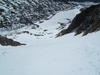
Post-storm pic of Indy pass taken by a CDOT camera:

If only they didn't close the pass yesterday! OCCUPY CDOT
-
11-02-2011, 01:27 PM #7094
Rollin with the Tide
- Join Date
- May 2006
- Location
- Eagle County
- Posts
- 12,637
sunny and cold day....tonight should be the coldest of the year. I'm already stoked for the weekend storm...and the Bama game
 ROLL TIDE ROLL
-
11-02-2011, 03:00 PM #7095
 plus size lifestyle model

- Join Date
- Aug 2005
- Location
- WHEREAS,
- Posts
- 12,936
This will determine the outcome of the ski season, FWIW. Originally Posted by montanaskier
Last edited by Rontele; 11-02-2011 at 03:15 PM.
Originally Posted by Roo
-
11-02-2011, 04:13 PM #7096
Rollin with the Tide
- Join Date
- May 2006
- Location
- Eagle County
- Posts
- 12,637
I've made no deal so go ahead and cheer for the Tide. This storm looks more like a southern storm today and Friday looks really warm. Hoping that once the wind shifts it'll hammer up here. I've got the entire day off to run errands and get ready for the game...so bring it ULLR.
ROLL TIDE ROLL
-
11-02-2011, 06:51 PM #7097
Down Under Wonder
- Join Date
- Jan 2010
- Location
- PRB, CO
- Posts
- 121
Haven't got around to that and am too slammed to deal at the moment, sorry. If you're after a particular station, hourly measurements are available in tabular or chart form on the NRCS SNOTEL pages for each station (though you probably know that already). Originally Posted by Lindahl
-
11-02-2011, 08:33 PM #7098
Registered Nutcase
- Join Date
- Sep 2010
- Location
- Golden, Colorado
- Posts
- 5,879
suckage! Originally Posted by JaytaeMoney
-
11-02-2011, 09:58 PM #7099
Skiing Kayaker
- Join Date
- Dec 2010
- Location
- Boulder, CO
- Posts
- 58
@Gratzo
Read all the stuff you wrote on Opensnow about how to make it look as much as the old CPF as possible, but I'm having trouble. I can get all of the 5-day forecasts to show up together. I linked my facebook to it, but I still have to click details. I was wondering why you would want to hide the best feature of CPF and make it a task to see the forecasts? I see potential in the site, but as of now it is not the most convenient.
-
11-03-2011, 12:39 AM #7100
Registered User
- Join Date
- Mar 2009
- Location
- Boulder
- Posts
- 490
Well, I didn't *want* to make it a task to see the forecasts, but in the sprint to get the site up and rolling, it worked out that way. We'll be making some BIG changes over the next 1-2 weeks to once again make it quicker and easier to access the best info. And, my dad was also pissed that he had to log in and threatened to remove his endorsement of "#1 forecasting website", so now we're forced to reevaluate the design. Hang tight - we'll get it right soon. Originally Posted by .simonb.
By the way, Saturday = Wolf. Sunday AM = central/north
JOELThe artist formerly known as Colorado Powder Forecast: http://www.opensnow.com

 Reply With Quote
Similar Threads
-
Up to the Minute Colorado Backcountry Weather Conditions
By AzureAbyss in forum General Ski / Snowboard DiscussionReplies: 13Last Post: 03-07-2011, 11:16 PM -
anti jinx, anti jinx, anti jinx thread
By Benny Profane in forum General Ski / Snowboard DiscussionReplies: 0Last Post: 02-10-2006, 12:34 AM -
The Colorado crew STOKE thread.
By Blurred Elevens in forum TGR Forum ArchivesReplies: 18Last Post: 07-12-2004, 11:16 PM -
a REPLY without a thread...
By Endlessseason in forum TGR Forum ArchivesReplies: 12Last Post: 10-28-2003, 09:44 AM

Bookmarks