
Bump for SoCal. Multiple Santa Ana Wind fires happening in Malibu and LA, Ventura, and San Diego Countys.
Results 101 to 125 of 138
Thread: 2007 Fire Season Roll Call
-
10-21-2007, 05:18 PM #101

 TGR gossiper
- Join Date
- Mar 2005
- Location
- San Diego/Santa Monica/Mammoth Lakes
- Posts
- 1,083
-
10-22-2007, 10:40 AM #102
 Calmer then you are Dude
- Join Date
- Oct 2004
- Location
- Truckee
- Posts
- 1,242
Yup 10 fire jumps. Originally Posted by Meadow Skipper

-
10-22-2007, 02:32 PM #103
 Vanilla snowflake killa
- Join Date
- Mar 2003
- Location
- MiZZZZoula
- Posts
- 3,146
My OT tally doesn't really apply to the FS/BLM standards b/c I'm not a full time brush monkey (which is the way I like it now). But I did good for our standards and got out on 2 rolls, totaling 20 days on assignment.
That ===== 270 hours of OT beotchhhhhhhes!
-
10-22-2007, 04:57 PM #104
 doesn't have an iPhone
- Join Date
- Mar 2007
- Posts
- 476
Yup. Left my SD house this morning. It looked like a war zone with ash everywhere and clouds of smoke blowing overhead. On a lighter note, those santa anas made for some good surf! Originally Posted by Gebster
I see Blue; He looks glorious.
-
10-22-2007, 11:17 PM #105
 Me encanta el país alto
- Join Date
- Dec 2005
- Location
- 山
- Posts
- 16,761
Bad news for SoCal on Tuesday, Hang on. Originally Posted by Gebster
http://fire.boi.noaa.gov/FIREWX/LAXFWFSGX.html
FIRE WEATHER PLANNING FORECAST FOR EXTREME SOUTHWESTERN CALIFORNIA...CORRECTED
NATIONAL WEATHER SERVICE SAN DIEGO CA
ISSUED BY NATIONAL WEATHER SERVICE LOS ANGELES/OXNARD CA
304 PM PDT MON OCT 22 2007
...RED FLAG WARNING EFFECT UNTIL 3 PM WEDNESDAY FOR STRONG NORTHEAST
TO EAST WINDS AND LOW RELATIVE HUMIDITIES...
.DISCUSSION...
AN UPPER LEVEL HIGH PRESSURE SYSTEM LOCATED OFF THE NORTHERN
CALIFORNIA COAST COMBINED WITH SURFACE HIGH PRESSURE OVER THE
GREAT BASIN WILL CONTINUE TO BRING HOT...DRY...AND STRONG SANTA
ANA CONDITIONS WITH EXPLOSIVE FIRE GROWTH POTENTIAL TO THE COAST THROUGH
TUESDAY...THEN WINDS WILL BEGIN TO TAPER OFF BY WEDNESDAY.
HOWEVER...THE CONTINUATION OF VERY DRY CONDITIONS HAS PROMPTED THE
RED FLAG WARNING TO BE EXTENDED THROUGH WEDNESDAY AFTERNOON. SLOW
COOLING WILL BEGIN THURSDAY. A WEAK UPPER LEVEL LOW PRESSURE
SYSTEM IN THE VICINITY OF THE CALIFORNIA COAST SHOULD BRING SOME
ADDITIONAL COOLING AND MOISTENING FOR THE WEEKEND.
ORANGE COUNTY COASTAL AREAS-
304 PM PDT MON OCT 22 2007
...RED FLAG WARNING IN EFFECT UNTIL 3 PM PDT WEDNESDAY FOR STRONG NORTHEAST
TO EAST WINDS AND LOW RELATIVE HUMIDITIES...
.TONIGHT...
SKY/WEATHER.........CLEAR. AREAS OF SMOKE AND PATCHY BLOWING DUST.
MIN TEMPERATURE.....59 TO 64.
MAX HUMIDITY........5 TO 10 PERCENT.
WIND (20 FT)........WINDS NORTHEAST 15 TO 25 MPH...WITH GUSTS TO
45 MPH...INCREASING TO 20 TO 30 MPH WITH GUSTS
TO 50 MPH AFTER MIDNIGHT.
.TUESDAY...
SKY/WEATHER.........SUNNY. AREAS OF SMOKE AND PATCHY BLOWING DUST.
MAX TEMPERATURE.....88 TO 93 NEAR THE COAST TO 95 TO 100 INLAND.
MIN HUMIDITY........5 PERCENT INLAND TO 10 TO 15 PERCENT NEAR THE
COAST.
WIND (20 FT)........WINDS NORTHEAST 20 TO 30 MPH...WITH GUSTS TO 50 MPH
IN THE MORNING...DIMINISHING TO 15 TO 25 MPH WITH
GUSTS TO 45 MPH IN THE AFTERNOON.
.TUESDAY NIGHT...
SKY/WEATHER.........CLEAR.
MIN TEMPERATURE.....58 TO 63.
MAX HUMIDITY........10 TO 20 PERCENT INLAND TO 20 TO 30 PERCENT
NEAR THE COAST.
WIND (20 FT)........WINDS NORTHEAST 15 TO 25 MPH...DIMINISHING TO
10 TO 20 MPH AFTER MIDNIGHT.
LAL.................1.
SAN DIEGO COUNTY COASTAL AREAS-
304 PM PDT MON OCT 22 2007
...RED FLAG WARNING IN EFFECT UNTIL 3 PM PDT WEDNESDAY FOR STRONG
NORTHEAST TO EAST WINDS AND LOW RELATIVE HUMIDITIES...
.TONIGHT...
SKY/WEATHER.........CLEAR. AREAS OF SMOKE.
MIN TEMPERATURE.....55 TO 65.
MAX HUMIDITY........15 TO 30 PERCENT.
WIND (20 FT)........WINDS EAST 15 TO 25 MPH WITH LOCAL GUSTS TO 50 MPH.
.TUESDAY...
SKY/WEATHER.........SUNNY. AREAS OF SMOKE.
MAX TEMPERATURE.....88 TO 93.
MIN HUMIDITY........5 TO 10 PERCENT.
WIND (20 FT)........WINDS NORTHEAST 15 TO 25 MPH WITH LOCAL GUSTS TO
50 MPH IN THE MORNING.
.TUESDAY NIGHT...
SKY/WEATHER.........CLEAR.
MIN TEMPERATURE.....55 TO 62.
MAX HUMIDITY........20 TO 35 PERCENT.
WIND (20 FT)........WINDS EAST 10 TO 15 MPH.
CAZ250-232215-
SAN DIEGO COUNTY INLAND VALLEYS-
304 PM PDT MON OCT 22 2007
...RED FLAG WARNING IN EFFECT UNTIL 3 PM PDT WEDNESDAY FOR STRONG NORTHEAST
TO EAST WINDS AND LOW RELATIVE HUMIDITIES...
.TONIGHT...
SKY/WEATHER.........CLEAR. AREAS OF SMOKE AND PATCHY BLOWING DUST.
MIN TEMPERATURE.....60 TO 67.
MAX HUMIDITY........10 TO 15 PERCENT.
WIND (20 FT)........WINDS EAST 25 TO 35 MPH...WITH LOCAL GUSTS TO 70 MPH.
STRONGEST AFTER MIDNIGHT
.TUESDAY...
SKY/WEATHER.........SUNNY. AREAS OF SMOKE AND PATCHY BLOWING DUST.
MAX TEMPERATURE.....92 TO 97.
MIN HUMIDITY........5 PERCENT.
WIND (20 FT)........WINDS EAST 15 TO 25 MPH.
.TUESDAY NIGHT...
SKY/WEATHER.........CLEAR.
MIN TEMPERATURE.....57 TO 62.
MAX HUMIDITY........20 TO 30 PERCENT.
WIND (20 FT)........WINDS EAST 10 TO 20 MPH WITH LOCAL
GUSTS TO 35 MPH.
SAN BERNARDINO AND RIVERSIDE COUNTY VALLEYS-THE INLAND EMPIRE-
304 PM PDT MON OCT 22 2007
...RED FLAG WARNING IN EFFECT UNTIL 3 PM PDT WEDNESDAY FOR STRONG NORTHEAST
TO EAST WINDS AND LOW RELATIVE HUMIDITIES...
.TONIGHT...
SKY/WEATHER.........CLEAR. AREAS OF SMOKE AND BLOWING DUST.
MIN TEMPERATURE.....59 TO 66.
MAX HUMIDITY........10 TO 15 PERCENT.
WIND (20 FT)........WINDS NORTHEAST 30 TO 40 MPH WITH GUSTS TO 70 MPH.
.TUESDAY...
SKY/WEATHER.........SUNNY. AREAS OF SMOKE AND BLOWING DUST.
MAX TEMPERATURE.....91 TO 98.
MIN HUMIDITY........5 PERCENT.
WIND (20 FT)........WINDS NORTHEAST 25 TO 35 MPH WITH LOCAL GUSTS
TO 70 MPH...DIMINISHING 15 TO 30 MPH WITH LOCAL
GUSTS TO 50 MPH IN THE AFTERNOON.
.TUESDAY NIGHT...
SKY/WEATHER.........CLEAR.
MIN TEMPERATURE.....56 TO 62.
MAX HUMIDITY........15 TO 20 PERCENT.
WIND (20 FT)........WINDS NORTHEAST 15 TO 25 MPH...WITH LOCAL
GUSTS TO 35 MPH.
SAN BERNARDINO COUNTY MOUNTAINS-
INCLUDING THE MOUNTAIN TOP AND FRONT COUNTRY RANGER DISTRICTS OF
THE SAN BERNARDINO NATIONAL FOREST-RIVERSIDE COUNTY MOUNTAINS-
INCLUDING THE SAN JACINTO RANGER DISTRICT OF THE SAN BERNARDINO
NATIONAL FOREST-
304 PM PDT MON OCT 22 2007
...RED FLAG WARNING IN EFFECT UNTIL 3 PM PDT WEDNESDAY FOR STRONG NORTHEAST
TO EAST WINDS AND LOW RELATIVE HUMIDITIES...
.TONIGHT...
SKY/WEATHER.........CLEAR. AREAS OF SMOKE.
MIN TEMPERATURE.....39 TO 50.
MAX HUMIDITY........10 TO 15 PERCENT.
WIND (20 FT)........
SLOPES...........WINDS NORTHEAST 30 TO 40 MPH...WITH LOCAL
GUSTS TO 70 MPH
RIDGETOP.........WINDS NORTHEAST 30 TO 40 MPH...WITH LOCAL
GUSTS TO 70 MPH.
.TUESDAY...
SKY/WEATHER.........SUNNY. AREAS OF SMOKE.
MAX TEMPERATURE.....69 TO 79.
MIN HUMIDITY........5 TO 10 PERCENT.
WIND (20 FT)........
SLOPES...........WINDS NORTHEAST 25 TO 35 MPH WITH LOCAL GUSTS
TO 50 MPH IN THE AFTERNOON...DIMINISHING SOME
IN THE AFTERNOON.
RIDGETOP.........WINDS NORTHEAST 25 TO 35 MPH...WITH LOCAL
GUSTS TO 50 MPH.
.TUESDAY NIGHT...
SKY/WEATHER.........CLEAR.
MIN TEMPERATURE.....43 TO 53.
MAX HUMIDITY........25 TO 35 PERCENT.
WIND (20 FT)........
SLOPES...........WINDS EAST 15 TO 25 MPH...WITH LOCAL GUSTS TO 40 MPH.
RIDGETOP.........WINDS EAST 15 TO 25 MPH...WITH LOCAL GUSTS TO 40 MPH.
LAL.................1.
SANTA ANA MOUNTAINS-
INCLUDING THE TRABUCO RANGER DISTRICT OF THE CLEVELAND NATIONAL
FOREST-
304 PM PDT MON OCT 22 2007
...RED FLAG WARNING IN EFFECT UNTIL 3 PM PDT WEDNESDAY FOR STRONG NORTHEAST
TO EAST WINDS AND LOW RELATIVE HUMIDITIES...
.TONIGHT...
SKY/WEATHER.........CLEAR. AREAS OF SMOKE.
MIN TEMPERATURE.....65 TO 70.
MAX HUMIDITY........10 PERCENT.
WIND (20 FT)........
SLOPES...........WINDS NORTHEAST 30 TO 40 MPH...WITH LOCAL GUSTS
TO 70 MPH.
RIDGETOP.........WINDS NORTHEAST 20 TO 40 MPH....WITH LOCAL GUSTS
TO 70 MPH.
.TUESDAY...
SKY/WEATHER.........SUNNY. AREAS OF SMOKE.
MAX TEMPERATURE.....87 TO 97.
MIN HUMIDITY........5 PERCENT.
WIND (20 FT)........
SLOPES...........WINDS NORTHEAST 25 TO 35 MPH...WITH LOCAL GUSTS TO
65 MPH...DIMINISHING TO 20 TO 30 MPH IN THE AFTERNOON.
RIDGETOP.........WINDS NORTHEAST 25 TO 35 MPH...WITH LOCAL GUSTS
TO 65 MPH...DIMINISHING TO 20 TO 30 MPH IN THE
AFTERNOON.
.TUESDAY NIGHT...
SKY/WEATHER.........CLEAR.
MIN TEMPERATURE.....61 TO 67.
MAX HUMIDITY........10 TO 15 PERCENT.
WIND (20 FT)........
SLOPES...........WINDS NORTHEAST 10 TO 15 MPH...WITH LOCAL GUSTS TO 30
MPH.
RIDGETOP.........WINDS EAST 15 TO 25 MPH.
SAN DIEGO COUNTY MOUNTAINS-
INCLUDING THE PALOMAR AND DESCANSO RANGER DISTRICTS OF THE
CLEVELAND NATIONAL FOREST-
304 PM PDT MON OCT 22 2007
...RED FLAG WARNING IN EFFECT UNTIL 3 PM PDT WEDNESDAY FOR STRONG NORTHEAST
TO EAST WINDS AND LOW RELATIVE HUMIDITIES...
.TONIGHT...
SKY/WEATHER.........CLEAR. AREAS OF SMOKE AND PATCHY BLOWING DUST.
MIN TEMPERATURE.....53 TO 62.
MAX HUMIDITY........10 TO 15 PERCENT.
WIND (20 FT)........
SLOPES...........WINDS NORTHEAST 35 TO 45 MPH...WITH LOCAL GUSTS TO
75 MPH.
RIDGETOP.........WINDS EAST 35 TO 45 MPH...WITH LOCAL GUSTS TO 65 MPH.
.TUESDAY...
SKY/WEATHER.........SUNNY. AREAS OF SMOKE AND PATCHY BLOWING DUST.
MAX TEMPERATURE.....76 TO 86.
MIN HUMIDITY........5 PERCENT.
WIND (20 FT)........
SLOPES...........WINDS EAST 30 TO 40 MPH...WITH GUSTS TO 65
MPH...DIMINISHING TO 25 TO 35 MPH WITH LOCAL
GUSTS TO 50 MPH AFTER MIDNIGHT.
RIDGETOP.........WINDS EAST 30 TO 40 MPH WITH LOCAL GUSTS TO 50 MPH
AFTER MIDNIGHT.
.TUESDAY NIGHT...
SKY/WEATHER.........CLEAR.
MIN TEMPERATURE.....51 TO 60.
MAX HUMIDITY........10 TO 15 PERCENT.
WIND (20 FT)........
SLOPES...........WINDS EAST 20 TO 30 MPH...WITH LOCAL GUSTS TO
55 MPH..DIMINISHING TO 4O MPH AFTER MIDNIGHT.
RIDGETOP.........WINDS EAST 20 TO 30 MPH...WITH LOCAL GUSTS TO
55 MPH..DIMINISHING TO 4O MPH AFTER MIDNIGHT.
-
10-23-2007, 03:16 PM #106
 A very naughty rodent
- Join Date
- Oct 2003
- Location
- 写道
- Posts
- 13,607
It's like living in a campfire. At least work's been close the past two days and maybe tomorrow as well as there are numerous evacuation ones near where I work and the major north county fire is still unchecked.
Your dog just ate an avocado!
-
10-23-2007, 03:21 PM #107
 Questionable Tactics
- Join Date
- Nov 2004
- Location
- YetiMan
- Posts
- 13,368
holy socal shitshow!
this is one of those deals (like katrina) where I'm torn between wanting to be there and wanting nothing to do with it.
-
10-23-2007, 04:13 PM #108
Calmer then you are Dude
- Join Date
- Oct 2004
- Location
- Truckee
- Posts
- 1,242
Yup, me too. But since I know I wouldn't be going down there. I'll crack a beer and listen to the news people sound like uninformed and stupid assholes. Originally Posted by YetiMan
-
10-23-2007, 05:10 PM #109
 can fly!
- Join Date
- Jan 2004
- Posts
- 18,833
CDF fires suck. That is all. Good luck fellers.
-
10-23-2007, 11:36 PM #110
TGR gossiper
- Join Date
- Mar 2005
- Location
- San Diego/Santa Monica/Mammoth Lakes
- Posts
- 1,083
Huh? Do you mean that the typical SoCal Chapparel fires suck? or that CDF as a agency sucks compared to the forest circus? Originally Posted by telemike
-
10-24-2007, 07:28 PM #111
Questionable Tactics
- Join Date
- Nov 2004
- Location
- YetiMan
- Posts
- 13,368
yes..... Originally Posted by Gebster
-
11-03-2007, 02:24 PM #112
Questionable Tactics
- Join Date
- Nov 2004
- Location
- YetiMan
- Posts
- 13,368
2007 Fire Season SuperTR

Oh Hi! Here's some pics of my season.
this was my first year in Helitack, which is a pretty sweet job if you like helicopters...


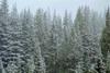
it's beautiful up there, out there....wherever we roam...


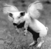
it's always fun to see some critters...


Last edited by ill-advised strategy; 11-03-2007 at 02:32 PM.
-
11-03-2007, 02:26 PM #113
Questionable Tactics
- Join Date
- Nov 2004
- Location
- YetiMan
- Posts
- 13,368
continued...
of course, the point here is to go fight some fire...
this year we had big ones

and small ones

desert

and timber

and everything in between...


of course any job is only as good as the folks you work with...


who's this handsome devil?

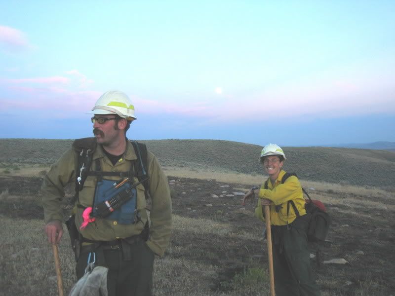


hookers?


Last edited by ill-advised strategy; 11-04-2007 at 04:37 PM.
-
11-03-2007, 02:27 PM #114
Questionable Tactics
- Join Date
- Nov 2004
- Location
- YetiMan
- Posts
- 13,368
of course it's not all hot line and helicopter rides...there's a lot of cargo to move


and plenty of downtime too....


it was a good season.
Thanks to EJ Brooks for taking all these pictures.
see you next year..

Last edited by ill-advised strategy; 11-04-2007 at 04:37 PM.
-
11-03-2007, 10:35 PM #115
 Registered User
- Join Date
- Dec 2005
- Location
- Glasgow, UK
- Posts
- 1,321
cool ass pics Yeti Man, thanks for posting those.
-
11-03-2007, 11:22 PM #116
 No longer as nomadic
- Join Date
- Apr 2006
- Location
- Movin' On
- Posts
- 3,954
Awesome TR Yeti. Looks like some incredible experiences.
-
11-04-2007, 08:43 AM #117
can fly!
- Join Date
- Jan 2004
- Posts
- 18,833
good stuff YetiMan
CDF fires are always a shitshow - I trust the con crews on the line more than those engine puppiesI didn't believe in reincarnation when I was your age either.
-
11-04-2007, 09:06 AM #118
 caught inside
- Join Date
- Mar 2006
- Location
- is Gorges
- Posts
- 4,095
Sweet TR Yeti.
-
11-05-2007, 06:03 PM #119
Me encanta el país alto
- Join Date
- Dec 2005
- Location
- 山
- Posts
- 16,761
Bump for fireline stoke, great pictures, fun fires, cool chicks with dirty faces, and a general shout-out to juice-sucking, shade-seeking, motel-monkey, rotorhead helislack everywhere.

Looks like a good season.
-
11-05-2007, 07:00 PM #120
 has many zippers
- Join Date
- Dec 2003
- Location
- here
- Posts
- 2,129
fkn great tr. some real sweet shots in here.
If it weren't for serendipity, there'd be no dipity at all
-
11-05-2007, 07:33 PM #121
 Just fuckin' with ya
- Join Date
- Jan 2007
- Location
- in a van down by the river
- Posts
- 2,768
Might as well add a few pics...
Had my first season on Initial (Heli) attack in BC good times, wish I took more photos.


hover entry:


-
11-05-2007, 08:22 PM #122
 Registered User
- Join Date
- Mar 2006
- Location
- truckee
- Posts
- 361
Yeti- nice photo tour of summer, ya forgot the bas-ics (keep the ics in)
-Locate
-Cooler
-Establish
-Shade"if you plant ice, you're gonna harvest wind..."
-
11-06-2007, 08:56 PM #123
Questionable Tactics
- Join Date
- Nov 2004
- Location
- YetiMan
- Posts
- 13,368
Helicopter 6-hotel-xray? Originally Posted by Meadow Skipper
 no no no
we're with Helicopter 6-hotel-xpected
-
12-01-2007, 06:27 PM #124
Registered User
- Join Date
- May 2005
- Posts
- 4,002
Got the chance to meet Kevo and a few of his classmates last nite for a beer. They're in the neighborhood for the S-130/190 at my fire brothers Colorado Fire camp. He's a good kid with his head on straight and eager for this stuff. Had plenty of good things to say about the pointers some of you fire maggots gave him. His pals are a fine lot too, but they sure got a strange look on their faces when they found out I just do Vol FD/local wildland with no pay... Small town/community ways didn't seem to compute.
I'm thinkin he did fine on the pack test today but one of his pals who was up here at 7-8,000 from Phoenix was worried cuz he was already suckin wind...
Keep encouragin our brother Kevo and help send him in the right direction if you can.
Kudos to you all for your efforts this season. Great stuff in here this year. I raise my glass to you all.
edit: Oh yeah. A bonus vid for you. Can't tell if it's scooping.... but it's fun to think it is.
Last edited by FrankZappa; 12-01-2007 at 06:29 PM.
-
12-01-2007, 08:46 PM #125
 Number 2 hippy


- Join Date
- Dec 2004
- Location
- The great north
- Posts
- 2,170
fun stuff. and yes... never forget your lces. oh and yea, the few times that i worked with cdf up north, they didn't know shit about our environment up here. nothing better than some douche nozzle strike team leader trying to tell you that you are going towards the wrong mountain, since he didn't know what mountain was where. fuck em.
backcountry makes my wee wee tingle...
"What was once a mighty river. Now a ghost." Edward Abbey
My Adventures Originally Posted by rideit
"Feeling good is good enough."

 Reply With Quote
Similar Threads
-
Cnd. Rockies early season roll call
By Eldo in forum TGR Forum ArchivesReplies: 17Last Post: 11-08-2004, 03:51 PM -
Wakey, Wakey.. Las Lenas Early Roll Call
By Squirrel99 in forum TGR Forum ArchivesReplies: 18Last Post: 05-04-2004, 09:47 AM -
KIRKWOOD ROLL CALL 5/1--5/2
By DJSapp in forum TGR Forum ArchivesReplies: 50Last Post: 04-30-2004, 08:46 PM -
Official Castle Mini Roll Call (XPost)
By two_planks in forum TGR Forum ArchivesReplies: 11Last Post: 01-22-2004, 05:08 PM

Bookmarks