
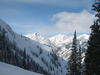
I think Indy Pass had better coverage in late Oct than G-8 has right now.
Results 7,576 to 7,600 of 42776
-
12-24-2011, 04:33 PM #7576
 Registered User
- Join Date
- Oct 2003
- Location
- Aspen
- Posts
- 9,565
-
12-24-2011, 05:24 PM #7577
 Rollin with the Tide
- Join Date
- May 2006
- Location
- Eagle County
- Posts
- 12,637
I don't like the odds of much snow this week and neither does NOAA but the continue to like the odds of a much snowier Jan (wouldn't take much) than Nov or Dec. I think it has snowed less than 2feet in Dec and half of htat fell in one "storm". Fingers crossed that the new year brings new results. Here is a pretty detailed look at the first part of winter and what is in store (we hope) for the rest of the winter.
http://www.crh.noaa.gov/images/bou/s...12_Outlook.pdfROLL TIDE ROLL
-
12-24-2011, 07:21 PM #7578
 The Summit
- Join Date
- Jan 2010
- Location
- In the swamp
- Posts
- 12,106
went snowshoeing up Chief Mtn today, above Echo...there's a SHITLOAD of powder up there
-
12-25-2011, 12:55 PM #7579
Registered User
- Join Date
- Oct 2003
- Location
- Aspen
- Posts
- 9,565
From aspenweather.net
Extended Forecast – The models are indicating a theme. The theme is we have some moisture around on Wednesday and Thursday but little if any upper air support. For this reason I’m not very excited about any real snow. Friday looks dry. After next Saturday the ensembles from many of our models are firmly in agreement that a large ridge sits over the Rockies and very dry weather will last at least another week.
Better start saving some $$$ for trips...
1976-77 anyone? Of course we could have a repeat of February '93, when it began snowing for 32 straight days.... that'd be nice.Last edited by funkendrenchman; 12-25-2011 at 01:20 PM.
-
12-25-2011, 01:51 PM #7580
 Registered User

- Join Date
- Apr 2008
- Location
- Victor, ID
- Posts
- 737
if we get another 2 weeks of dry weather it's going to take a miracle to even get the snowpack back to a mediocre/normal year.
-
12-25-2011, 01:59 PM #7581
 Registered User
- Join Date
- Apr 2008
- Location
- Canada
- Posts
- 1,271
I hope you guys get some snow in the next 2 weeks. Coming to visit your fine state for the first time jan 8th! Weather has looked rough for the last month.
-
12-25-2011, 03:39 PM #7582
Rollin with the Tide
- Join Date
- May 2006
- Location
- Eagle County
- Posts
- 12,637
well we always get the Jan thaw so 2 weeks of warm and sun is coming at some point. Many places in the northern mtns are on pace for a 100" season. The backcountry is a pile of facets on N and W aspects and virtually dry on S and E aspects below 10k. I'm starting to think that it might just be an uber shitty year and a very short spring.
ROLL TIDE ROLL
-
12-25-2011, 04:31 PM #7583
Registered User
- Join Date
- Feb 2006
- Location
- Northern San Juans
- Posts
- 1,033
This is just a stupid statement. It could be a shitty season and a short spring but nobody has any clue to what will happen. Last year telluride closed with 212 inches and around 75 percent of normal snowpack. Fast foward to May where the San Juans where at 120% of normal and the late season skiing was as good as its ever been. I skied lines in early June that normally are melted of in mid april. Again maybe this is 76-77 but no one has any clue. Originally Posted by montanaskier

-
12-25-2011, 05:27 PM #7584
Rollin with the Tide
- Join Date
- May 2006
- Location
- Eagle County
- Posts
- 12,637
which is why it isn't a statement...but an opinion and a weak one at that since I said "starting to think". It'll come at some point more than likely and I had a blast skiing deep facets today and I've had fun ripping groomers on resort days. I'm stoked that I have a 6 month old son so in the grand scheme of things if it never snows another flake or dumps a billion inches staring tonight it really doesn't matter. It's the little things that keep things in perspective. Originally Posted by deeppo
ROLL TIDE ROLL
-
12-25-2011, 05:32 PM #7585
 Registered User
- Join Date
- Sep 2009
- Location
- MST
- Posts
- 681
True, but even the little things are better with a couple feet of snow. Originally Posted by montanaskier
go upside down.
-
12-25-2011, 06:15 PM #7586
Registered User
- Join Date
- Feb 2006
- Location
- Northern San Juans
- Posts
- 1,033
Your absolutely right. Just trying to stay positive. In reality its been a good ski season for me. 31 day alpine(10 nordic). Most of them have been pseudo powder days. Telluride is mostly open and coverage is not horrible. Just hoping for some snow to roll in. Originally Posted by montanaskier
Let it snow
-
12-25-2011, 11:03 PM #7587
 Registered User
- Join Date
- Dec 2005
- Location
- Front Range, CO
- Posts
- 704
Great report with season cheer from the Avy center. Come one weds! Originally Posted by CAIC
-
12-26-2011, 10:02 AM #7588
Registered User
- Join Date
- Mar 2009
- Location
- Boulder
- Posts
- 490
Looking for a few inches Tue-Sat from Aspen on north, if things pan out OK. It's really tough to nail down the timing and intensity of any specific little storm ("wave") that moves through the fast WNW flow this week. There are hints that one wave on Friday into Saturday could be a bit stronger than the rest, but we'll have to see. At best, a few inches could fall for some ski areas and maybe better totals up around Buff pass and the northern divide around Cameron and RMNP (on the west sides).
The artist formerly known as Colorado Powder Forecast: http://www.opensnow.com
-
12-26-2011, 10:26 AM #7589
 Tree Riding Nutcase
- Join Date
- Jan 2009
- Location
- Vail
- Posts
- 629
Not so sure about this, the only thing that seems to be true about Colorado weather is the pattern is different every time, every year. I'd love to see some historical January numbers, would be curious to see if there were patterns. Originally Posted by montanaskier
Also wondering. If this is just the first week the pattern is forecast Not to split flow, significantly change? Why not more hope a better flow is starting? I had forgotten about split flows last year, but they're usually bad for Northern CO?
-
12-26-2011, 04:38 PM #7590
 Down Under Wonder
- Join Date
- Jan 2010
- Location
- PRB, CO
- Posts
- 121
I remember it being pretty ordinary in Dec 1998 (and in 1999 apparently, but I didn't go to Vail that year). CB is hurting as well. See below; yellow line is average, grey line is today. A far cry from last year. Am somewhat wishing I had a few Eldora days. Originally Posted by Puffin

-
12-26-2011, 08:53 PM #7591
 NewbItUp
- Join Date
- Jul 2008
- Posts
- 3,781
my butt hurts.
"this is totally loose butthole"
in all seriousness, just ski what's there, take them rock skis and go find some rocks, it's better than sitting at your computer and butthurting about the lack of snow. oh wait...Do I detect a lot of anger flowing around this place? Kind of like a pubescent volatility, some angst, a lot of I'm-sixteen-and-angry-at-my-father syndrome?
fuck that noise.
gmen.
-
12-26-2011, 09:26 PM #7592
Registered User
- Join Date
- Oct 2003
- Location
- Aspen
- Posts
- 9,565
You're right... at least there is so little snow that the bumps aren't very big. Originally Posted by volklpowdermaniac
-
12-26-2011, 11:28 PM #7593
 Drops in Heavy
- Join Date
- Nov 2009
- Location
- da eskalaterz
- Posts
- 1,200
A poem:
Learn to ski the tops of bumps,
As the troughs are grass, rocks, and stumps
-
12-27-2011, 06:57 AM #7594
Tree Riding Nutcase
- Join Date
- Jan 2009
- Location
- Vail
- Posts
- 629
I didn't think we were in worse shape than 2001-2002, but according to those numbers it's worse. Thx for sharing Blizzard of Oz, love comparing those numbers. There's still a lot left of the season and I still have hope we'll get into a wet period.
Last edited by PowTrees; 12-27-2011 at 09:46 AM.
-
12-27-2011, 07:46 AM #7595
Banned
- Join Date
- Aug 2009
- Location
- Splat's Garage
- Posts
- 4,287
Here's pretty thorough Jan-Mar 2012 Outlook PDF from NOAA.
http://www.crh.noaa.gov/images/bou/s...12_Outlook.pdf
-
12-27-2011, 08:11 AM #7596
Rollin with the Tide
- Join Date
- May 2006
- Location
- Eagle County
- Posts
- 12,637
BY EARLY NEXT WEEK...THE RIDGE WILL BE
SETTLING OVER THE ROCKIES...PROMISING A DRY START TO THE NEW YEAR.
MAYBE a couple of inches if we're lucky this week then back to dry for a week or so it seems. Temps look much warmer than they've been as well.ROLL TIDE ROLL
-
12-27-2011, 09:12 AM #7597
 Registered User
- Join Date
- Nov 2009
- Location
- Vail
- Posts
- 358
Thanks blizzard. Those graphs really put everything into perspective. Didn't realize this is literally about as thin as it gets for this time of year. Just figured it was a bad one looking at my last 8 years here.
-
12-27-2011, 09:27 AM #7598
Registered User
- Join Date
- Oct 2007
- Posts
- 13,648
This Madden-Julian bitch is the one causing our "La Nino" winter so far. Good news, it might be changing for the better.
http://www.crh.noaa.gov/images/bou/s...12_Outlook.pdf
For the cliff notes, scroll to the last few pages.
-
12-27-2011, 10:01 AM #7599
Registered User
- Join Date
- Feb 2007
- Location
- Colorado
- Posts
- 3,027
I'll believe it when I ski it. Until then, I'll be in montanaskier mode. Originally Posted by shredgnar
"High risers are for people with fused ankles, jongs and dudes who are too fat to see their dick or touch their toes.
Prove me wrong."
-I've seen black diamonds!
throughpolarizedeyes.com
-
12-27-2011, 10:21 AM #7600
 Death and Destruction
- Join Date
- Nov 2006
- Location
- ColoRADo
- Posts
- 5,957
Me too... Originally Posted by Bean
I have started saving a trip fund, and get my bonus in Late February. If the snow stays away from CO, I will be begging mags in the PNW and AK for couch space .
You should have been here yesterday!
.
You should have been here yesterday!

 Reply With Quote
Similar Threads
-
Up to the Minute Colorado Backcountry Weather Conditions
By AzureAbyss in forum General Ski / Snowboard DiscussionReplies: 13Last Post: 03-07-2011, 11:16 PM -
anti jinx, anti jinx, anti jinx thread
By Benny Profane in forum General Ski / Snowboard DiscussionReplies: 0Last Post: 02-10-2006, 12:34 AM -
The Colorado crew STOKE thread.
By Blurred Elevens in forum TGR Forum ArchivesReplies: 18Last Post: 07-12-2004, 11:16 PM -
a REPLY without a thread...
By Endlessseason in forum TGR Forum ArchivesReplies: 12Last Post: 10-28-2003, 09:44 AM

Bookmarks