
To quote winston wolfOriginally Posted by The Gnarwhale

"Lets not start sucking each other's dicks quite yet."
The event in question will come in the form of a diggin pacific trough that will sharpen off the california coast and swing inland. First on a SW flow precip will overspread the region on sunday night. Then as the trough moves inland a moist and somewhat unstable environment will prevail for roughly the next 48-60 hours. However the amout of embedded lift, upper level divergence and instablity will vary and isn't quite clear right now. So you have to temper excitement just a touch. From this far out I'd say a general 1-2 foot snowfall is reasonable for the Central and Northern Wasatch.
Results 326 to 350 of 2093
Thread: Wasatch Conditions 10-11
-
11-17-2010, 04:16 PM #326

 Dork.
Dork.
- Join Date
- Feb 2007
- Location
- Not Philly
- Posts
- 4,476
-
11-17-2010, 04:17 PM #327
 Git Sum
- Join Date
- Oct 2008
- Location
- Salt Lake City
- Posts
- 1,619
Edit: I will embed the Jaws theme closer to the date per lionelhutz's instructions. Originally Posted by The Gnarwhale
I like that we have our own personal TGR weather man. What channel can we find you on lionel? Originally Posted by TheDingleberry
-
11-17-2010, 04:39 PM #328
 Registered User
- Join Date
- Aug 2006
- Location
- Somewhere around the west
- Posts
- 2,587
Originally Posted by lionelhutz
"Your sending the Wolf?"Johnny's only sin was dispair
-
11-17-2010, 04:40 PM #329
 chasing the white whale
- Join Date
- Aug 2008
- Location
- Two Thousand Leagues
- Posts
- 1,014
Jesus. Lionel did I step on your toes and not know it? Originally Posted by lionelhutz
From the degree-holding meterologists at the UAC today:
Sheesh.Major storm system on tap for the weekend through next week. First wave arrives Saturday, coming in warm and windy, benefitting the Ogden and Provo and Park City mountains. Winds expected to be 40mph with strong gusts...Frontal passage at this time looks to be Saturday night as the Cottonwoods catch-up. Next waves arrive later Sunday and on through Wednesday-plus. Multiple feet of snow expected with this large scale Pacific trough.

Last edited by The Gnarwhale; 11-17-2010 at 04:53 PM.

-
11-17-2010, 04:50 PM #330
Registered User
- Join Date
- Aug 2006
- Location
- Somewhere around the west
- Posts
- 2,587
Disagreement among professionals is ok as long as no one gets killed.
Johnny's only sin was dispair
-
11-17-2010, 04:54 PM #331
Registered User
- Join Date
- Aug 2009
- Posts
- 3,449
i take noaa over wolf:
"Increasingly strong but mild southwest flow will be over the area through Friday. A broad trough will develop over the western U.S. this weekend with a series of storms rotating through the trough beginning Saturday. At this time it looks like we will see a 5 day long storm cycle from Saturday through Wednesday with potential for significant snowfall. Forecast confidence is higher than average for this event."
-
11-17-2010, 05:54 PM #332
Git Sum
- Join Date
- Oct 2008
- Location
- Salt Lake City
- Posts
- 1,619
 Originally Posted by TheDingleberry
-
11-17-2010, 06:22 PM #333
 Registered User
- Join Date
- Feb 2010
- Location
- Park City
- Posts
- 316
^^hopefully this storm pans out. Stuck to skiing mostly mellow stuff in upper LCC today. CT 16 Q2 below graupel 8'' down on a NE slope at apx.9800'.
"Officially known as Highway U-210, more commonly known as Little Cottonwood Canyon and unofficially acknowledged as the epicenter of the greatest snow on earth." Andrew McLean
-
11-17-2010, 06:37 PM #334
pura vida
- Join Date
- Mar 2006
- Location
- The bottom of LCC
- Posts
- 5,749
kind of a newb when it comes to this stuff but trying to learn more, at what point in a CT would it generally be considered safe to ski? Originally Posted by tyfalk
-
11-17-2010, 07:28 PM #335
Registered User
- Join Date
- Feb 2010
- Location
- Park City
- Posts
- 316
There are many others on here who could better answer this question than myself. There are more factors that would play into understanding if a slope is safe or not other than just that one test. But the depth of the failure, quality of fracture, pitch of the slope and a number of other things would make me feel one way or another on the results of a CT. Originally Posted by dfinn
"Officially known as Highway U-210, more commonly known as Little Cottonwood Canyon and unofficially acknowledged as the epicenter of the greatest snow on earth." Andrew McLean
-
11-17-2010, 07:35 PM #336
Dork.
- Join Date
- Feb 2007
- Location
- Not Philly
- Posts
- 4,476
No! I was just saying I think the some of the hype was a little premature as the system has been shown on some models to cut off a little too far off the cali coast. Maybe I should have been more clear. Originally Posted by The Gnarwhale
I have degrees. Originally Posted by The Gnarwhale
Regardless:
As we move into the weekend a large pacific trough will deepen as it swings down out off the coast of the California. As it deepens and swings into california and the west it will bring with it upper level divergence and an unstable moist airmass. Overall the system will first bring precip on a south west flow, then as the trough moves through region it will bring precip enhanced by a western flow. Precip will begin on sunday and last through at the least tuesday.
Adding all this up I'd suspect upper cottonwoods storm totals to reach 2-3 feet with more possible if the western flow remains steady and the vertical motion matches up.
-- TrackHead's right (See Below)--Last edited by lionelhutz; 11-17-2010 at 07:51 PM.
-
11-17-2010, 07:44 PM #337
 Hiding in AK
- Join Date
- Oct 2003
- Location
- Was UT, AK, now MT
- Posts
- 14,573
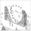
Maybe I'm not up to speed, but I doubt most readers of this thread are going to look at all those crazy rainbow depictions of flow, or whatever they are.
In the end, who gives a shit what the weather might do, doesn't mean shit until you wake up in the morning anyway.
-
11-17-2010, 08:03 PM #338
Banned
- Join Date
- Dec 2009
- Posts
- 7,167
general mystery
ah, the mysteries of snow.........so much still unknown............ Originally Posted by dfinn
for newb's and seasoned vets, a general overview of snow, wind, terrain, aspects, angles, and how everything affects, well, everything else is a long hands on learning process. read the local avi report every day whether yer going out or not and learn the speak, the warnings, the accident reports/pictures, and danger ratings. read a book, take a course and take frequent walks out into white world and take it all in.
another thing that is so important for snow know is getting out and spending time in other regions with different weather and snowpack makeup/stackup. someone may know/recognize a ton about the ways of a wasatch snowpack, but may not have a clue of how, say a maritime snowpack works. if shit hits the fan in the wasatch for someone that only knows that snowpack and they see something foreign from some strange weather event that basically throws them a curveball when assessing, it could cause some serious issues in deciding whether it's safe to go or better to no.
read, listen, learn, and go often. keep it simple and less than scientific to start, at least.
rog
-
11-17-2010, 08:18 PM #339
 User
User
- Join Date
- Oct 2003
- Location
- Ogden
- Posts
- 9,824
This^^^ Originally Posted by Trackhead
I used to pour over those maps and charts to figure out every minute detail of the upcoming storm. Over the years I've come to realize that all of the weather hype in the world is unimportant, if it snows it snows. Now I'm more concerned about what the storm did. What were the winds and where, what direction. Storm totals, water content, winds before the precip, temp change before, during. Stuff like that.
-
11-17-2010, 08:20 PM #340
User
- Join Date
- Oct 2003
- Location
- Ogden
- Posts
- 9,824
You'll never get a hard and fast number for stuff like that. This is not science, it's voodoo magic. Originally Posted by dfinn
-
11-17-2010, 08:22 PM #341
Dork.
- Join Date
- Feb 2007
- Location
- Not Philly
- Posts
- 4,476
In reality that's all that matters. Originally Posted by zion zig zag
-
11-17-2010, 08:23 PM #342
Banned
- Join Date
- Dec 2009
- Posts
- 7,167
big storms, big hype
that^^^^^^^^ Originally Posted by zion zig zag
and then the fucking thing becomes a splitter. better to just sleep on it.
-
11-17-2010, 08:36 PM #343
 victimville
- Join Date
- Nov 2003
- Location
- das heights
- Posts
- 2,542
Just to add to the hype, from today's 3p discussion:
TIME/HEIGHT SECTIONS FROM GFS SHOW A SATURATED UNSTABLE AIRMASS
THROUGH 470 MB WITH STRONG DYNAMIC LIFT AND STRONG FLOW FOR
OROGRAPHICS. THIS POTENT SITUATION CONTINUES FOR DAYS. IF TODAY`S 12Z
RUNS PROVE CORRECT...5 DAY STORM TOTAL SNOWFALL IN THE NORTHERN
AND CENTRAL MOUNTAINS COULD BE VERY LARGE...MANY FEET...BY LATE
WEDNESDAY.
-
11-17-2010, 11:03 PM #344
Hiding in AK
- Join Date
- Oct 2003
- Location
- Was UT, AK, now MT
- Posts
- 14,573
Report from the 'roy.
Shredding the gnar corduroy on the 44mm wide, edgeless fruit boot skis. Got some weird looks from the brah's at Alta skating up the groomers, then hacking my way down. Good way to build the lungs and the skilz for the phat skeez.

-
11-17-2010, 11:11 PM #345
Git Sum
- Join Date
- Oct 2008
- Location
- Salt Lake City
- Posts
- 1,619
^^^ Nice!
Originally Posted by TheDingleberry
-
11-18-2010, 12:35 AM #346
Registered User
- Join Date
- Aug 2009
- Posts
- 3,449
so is alta allowing uphill now? Originally Posted by Trackhead
-
11-18-2010, 06:39 AM #347
Hiding in AK
- Join Date
- Oct 2003
- Location
- Was UT, AK, now MT
- Posts
- 14,573
Well, they allowed me, but they probably felt sorry for me. Originally Posted by Slaag Master
-
11-18-2010, 06:43 AM #348
Dork.
- Join Date
- Feb 2007
- Location
- Not Philly
- Posts
- 4,476
The vertical motion is really off the charts from like the 21st to the 22nd. That's very very good. Originally Posted by pointedem
-
11-18-2010, 10:49 AM #349
Registered User
- Join Date
- Aug 2006
- Location
- Somewhere around the west
- Posts
- 2,587
50 would be a good solid number, with a Q3++ Originally Posted by dfinn
Seriously, take an avy course.Johnny's only sin was dispair
-
11-18-2010, 10:55 AM #350
 ExteriorDecorator
- Join Date
- Nov 2005
- Location
- Down In A Hole, Up in the Sky
- Posts
- 36,513
Just HAD to X-post this...
http://www.xtranormal.com/watch/7661505/
So, who is this at BD? Forum Cross Pollinator, gratuitously strident


 Reply With Quote
Bookmarks