
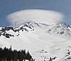
slippery 80 is no joke right now.. 5"+ slushie in parts was surprised as many people were holding it as together as they were
snow was heavier today than yesterday by quite a bit unfortunately.. but it's great for coverage. filled in properly now
Results 926 to 950 of 4591
-
01-04-2017, 07:02 PM #926
 Sav
Sav
- Join Date
- Jan 2007
- Posts
- 616
-
01-04-2017, 07:04 PM #927
 Not on IR. For now.
- Join Date
- Jun 2006
- Location
- Couloirfornia
- Posts
- 8,874
To add to what Schralph and 213 said...
The January 1997 storm had the water level up to the top of the arches on No Hands Bridge (Confluence of the North and Middle Fork American)...
http://www.calexplornia.com/mountain...-hands-bridge/
The February 1986 storm completely submerged it, apparently.
If anybody else wants to nerd out, here are some historical analogs to what we may see on Sunday/Monday...
http://www.cnrfc.noaa.gov/storm_summaries/jan1997storms.php
http://www.cnrfc.noaa.gov/storm_summaries/dec2005storms.php
(I watched Old 40 under several feet of churning flood waters at Cisco on December 31, 2005. Pretty impressive.)
And then these for Southern Cal...
http://www.cnrfc.noaa.gov/storm_summaries/jan2005storms.php
http://www.cnrfc.noaa.gov/storm_summaries/dec2010storms.php
The peak flow estimate on the American at Folsom during the January 1997 event was 295,000 CFS. The best estimate I've seen for the "Great Flood of (January) 1862" is between 440,000 and 470,0000 CFS. (213 may have a critique of that paper, but it's fascinating either way.)
See more discussion here...
http://www.tetongravity.com/forums/s...ic-River-Event
#waternerdery Originally Posted by Ernest_Hemingway

-
01-04-2017, 07:06 PM #928
 Wax on, scrape off ...
- Join Date
- Mar 2007
- Location
- Eugenio Oregón
- Posts
- 8,858
Nicely done 213, should have figured you were connected to some of that research.
_______________________________________________
"Strapping myself to a sitski built with 30lb of metal and fibreglass then trying to water ski in it sounds like a stupid idea to me.
I'll be there." ... Andy Campbell
-
01-04-2017, 07:29 PM #929
Wax on, scrape off ...
- Join Date
- Mar 2007
- Location
- Eugenio Oregón
- Posts
- 8,858
Damn this is totally off topic but I hope this forecast is way wrong, on the ambitious side, not on the conservative side.
Yose Valley Merced River forecasted at 23'!!! Just inches shy of 1997!!!
http://water.weather.gov/ahps2/hydro...=pohc1&wfo=hnx_______________________________________________
"Strapping myself to a sitski built with 30lb of metal and fibreglass then trying to water ski in it sounds like a stupid idea to me.
I'll be there." ... Andy Campbell
-
01-04-2017, 08:03 PM #930
Registered User
- Join Date
- Sep 2016
- Posts
- 141
I'm doing some calculations now to see how this weekend's forecast lines up with some of the other biggest moisture transport (precip) events (1997 and 1862). At this rate, water year (WY) 2017 is going to give WY1997 a run for its money. Thanks to the 1997 flood event, that year holds the record for most integrated moisture transport (wind times moisture, integrated vertically through the atmosphere) along the Sierra Crest at Sonora Pass as seen here in Figure 3a from a recent paper:
The total moisture transport for Oct-Apr is on the x-axis, Walker Lake Basin (Sonora/Bridgeport headwaters) precipitation on the y-axis. Dots are colored by the fraction of total moisture supplied by >95th percentile days (a surrogate way to count atmospheric river days) and sized by the number of AR days. 1896-2012 shown. Note how the wetter years tend to have more ARs and get a larger contribution of total season moisture from ARs. 1997 was actually somewhat dry minus the massive storm cycle culminating with the flood event.
LightRanger, thanks for the paper! Gary does a great job with the California Extreme Precip Symposium at the event and capturing all of the cool work presented there for the archives.
At least we will have the ice planet Lemuria to shred upon after all this unfolds...213 in 2015 by Josh Hejl Photography:
-
01-04-2017, 08:37 PM #931
 Registered User
- Join Date
- Dec 2011
- Location
- North Tahoe
- Posts
- 52
Watch that hang fire! Originally Posted by AKbruin
-
01-04-2017, 08:49 PM #932
 Registered User
- Join Date
- Oct 2003
- Location
- Tahoe
- Posts
- 2,750
Was up at Rose this AM, one of the gnarliest drives ever to get there. And I'm not talking 431, that was a breeze. Getting out of my parking lot and through Incline streets, I was bouncing all over the place, just trying to keep my momentum up, lucked out and no oncoming traffic. Once I hit Country Club it was smooth sailing.
So the skiing was pretty good, a bit thick but not too heavy. A little after 10 they shut down the resort. NDOT had closed 431 and no vehicles could get up in the event of an emergency, so no more skiing. Road was shut in both directions. I waited in the lodge for almost 4 hours, finally headed down the hill about 2:15 as going straight home was not an option. Cut through St James, gotta In-n-Out in Carson then over Spooner and back home just after 4:30. Sure am glad I put the studs on on Sunday!
I heard all kinds of stories but I'm pretty sure this is somewhat accurate. There was a slide somewhere below Rose on the Reno side which caused NDOT to close the hwy. Then there were multiple spinouts/accidents as they tried to clear out all the skiers.
A tour bus (or 2?) spun out right near the top on the Lake side and blocked the hwy. There were no tow trucks big enough on the lake side, so they needed 1st to clear out all the skier traffic, so they could send the heavy machinery up, bomb the road and clear it, and then get the tow trucks up to clear the bus(ses). Road is still closed, probably won't open til morning."The mind, once expanded to the dimensions of larger ideas, never returns to its original size."
-
01-04-2017, 08:57 PM #933
Registered User
- Join Date
- Oct 2003
- Location
- Tahoe
- Posts
- 2,750
I've got kind of a funny story about this. After living in Tahoe for 4 years, I spent that winter at Jackson Hole. Just about everything I owned I put in a storage locker in South Reno. I see on CNN, guys cruising around the casinos downtown in rowboats and figure I'm just completely fucked and it's all under water. Originally Posted by SchralphMacchio
Turned out I chose the right location and all my stuff was fine, but I'll never forget that feeling when I first saw the flooding."The mind, once expanded to the dimensions of larger ideas, never returns to its original size."
-
01-04-2017, 09:00 PM #934
 Deepo days
- Join Date
- Jun 2007
- Location
- Cruzing
- Posts
- 12,172
Spur has been closed all day. Full blizzard conditions today at the base. I'd estimate four to five feet of snow has fallen this week. Originally Posted by SchralphMacchio
Still hovering around 32 at 7800'.
-
01-04-2017, 09:20 PM #935
 yawn.
yawn.
- Join Date
- Jan 2005
- Location
- Access to Granlibakken
- Posts
- 11,933
Dropped from 33 F to 32 F an hour ago in Meyers, and the snain turned to snow. Or at least a form of snow. RH somehow seems above 100%. Reminds me of a mt baker storm.
-
01-04-2017, 09:33 PM #936
 Registered User
- Join Date
- Apr 2012
- Location
- California
- Posts
- 277
Originally Posted by spnce

Clearly some truth to this. Pic via the facespace.
-
01-04-2017, 09:47 PM #937
Registered User
- Join Date
- Apr 2006
- Location
- SF & the Ho
- Posts
- 11,008
Impressed by your treehouse. Is it on Airbnb? Originally Posted by AKbruin
-
01-04-2017, 10:09 PM #938
glocal
- Join Date
- May 2002
- Posts
- 33,437
With the snow that's dropped, all it has to do is rain to the top for a 97 like flood. It's looking much the same. The earth has saturated where its raining. Sounds like it's gonna leave a nasty ice layer.
-
01-04-2017, 10:16 PM #939
Deepo days
- Join Date
- Jun 2007
- Location
- Cruzing
- Posts
- 12,172
Yeah. Sure glad I'm getting it this week and next. This weekend sound like it is going to be crazy.
Looking forward to tomorrow. I go out early and then meet my wife after she drops the kid off at 10:30 ski school. Stil snowing up here, but seems lighter the past few hours.
-
01-04-2017, 10:57 PM #940
 Safety Inspector
- Join Date
- Mar 2008
- Location
- lake level
- Posts
- 1,563
How long ago was it that people were freaking out because CA was gonna turn into a desert?
“I really lack the words to compliment myself today.” - Alberto Tomba
-
01-04-2017, 10:58 PM #941
 Registered User
- Join Date
- Mar 2008
- Location
- Da Norf Lake
- Posts
- 2,502
I know, right? And they were saying the climate was warming too. Then why is it snowing? Originally Posted by mmmm...pow!
Even sometimes when I'm snowboarding I'm like "Hey I'm snowboarding! Because I suck dick, I'm snowboarding!" --Dan Savage
-
01-04-2017, 11:04 PM #942
Registered User
- Join Date
- Mar 2014
- Location
- Riding my Onewheel to Hooli
- Posts
- 70
Last time I went to Death Valley it SNOWED. Originally Posted by mmmm...pow!
Needless to say, I got my money back.
-
01-04-2017, 11:31 PM #943
Deepo days
- Join Date
- Jun 2007
- Location
- Cruzing
- Posts
- 12,172
I take back the light statement. Just shovels again and it felt like 6 or more inches in the last four hours. Very little wind though.
-
01-04-2017, 11:34 PM #944
 Old Gaper
- Join Date
- Oct 2003
- Location
- The bleak, beautiful desert
- Posts
- 225
Cool links LightRanger. Thanks for posting.
213, interesting that 1983 had no pineapple expresses. I'm old. Ive been through 82-83 and the Pineapple Expresses of 86, 97, and 05. I refuse to call them AR events.
So far they are only calling for a 12 foot plus crest on the Truckee at Vista. I dont beleive it.
-
01-04-2017, 11:59 PM #945
Registered User
- Join Date
- Apr 2010
- Location
- Reno
- Posts
- 507
Avalanche on slide road. Wow that sucks, glad I went to work today. Originally Posted by powpig
-
01-05-2017, 12:54 AM #946
 Corn Harvester
- Join Date
- Nov 2016
- Location
- SoTahoe
- Posts
- 190
great account of event. hope turns were good before road adventure Originally Posted by Nevada29er
-
01-05-2017, 01:43 AM #947
Registered User
- Join Date
- Sep 2016
- Posts
- 141
1983 had a large number (big dot), but they didn't contribute as much to the total moisture transport (middle blue color). Classically, the pineapple express refers to moisture plumes originating in the eastern Pacific (Hawaii eastward) while the Mango Connection has to do with those originating further west of Hawaii (in the Philippines/Indo). Whatever you want to call it, atmospheric river, enhanced horizontal moisture transport, pineapple express, or general awesomeness, IT'S COMIN RIGHT FOR US! Originally Posted by gageyk
Here's 1997 versus the forecast for comparison. Never mind the units, just look at the colors (my figure is a 3 hour slice, the CW3E forecast sums up the IVT).
-
01-05-2017, 01:50 AM #948
Not on IR. For now.
- Join Date
- Jun 2006
- Location
- Couloirfornia
- Posts
- 8,874
Yeah man. This is fascinating stuff. I recall reading something else in the last year or three about how a way higher percentage of CA's precip than we previously knew comes from AR events. I want to say it was a paper or article by one of the folks at Scripps? Sounds right. Originally Posted by 2_1_3
I'd be curious to know where the March 1982 event stacks up. I'd imagine it was some kind of AR too.
http://tahoetopia.com/news/tragic-al...-march-31-1982The spring storm that built into the fatal slide began on March 27. By 7 a.m. on March 31, nearly 90 inches of snow had fallen on top of an already-large, 87-inch base at Alpine Meadows.
Welcome. I love this shit. Terminology change was interesting for sure. Largely an effect of how much more we've learned about these things in just the last ten years. Way better data than back in the 90s and before. Originally Posted by gageyk
Originally Posted by Ernest_Hemingway
-
01-05-2017, 11:12 AM #949
 Registered User
- Join Date
- Mar 2006
- Posts
- 20,181
MAKE TAHOE DEEP AGAIN ~ 2016/17 OFISHUL SNOW/FOOD/WHINE & STOKE THREAD

Last edited by 4matic; 01-05-2017 at 11:41 AM.
-
01-05-2017, 11:40 AM #950
 Expert Jong
- Join Date
- May 2011
- Location
- Truckee & Nor Cal
- Posts
- 16,402
3 feet of snow overnight is sweet. The power being out since 4am is not so sweet. This weekend is going to be an all time shit show.

 Reply With Quote

Bookmarks