
Reading many years of awesome TRs for the North Rim led to a return trip over Memorial Day weekend to do some bikepacking. Years ago I rode the Rainbow Rim trail but have never checked out any of the Arizona Trail segments up there. Its not an easy place to get to from SoCal and there are many other choice destinations closer to home.
I have to give a lot of credit to Schillingsworth for the route I took. I combined two routes he rode over the last couple years into one that would hit all the singletrack segments I wanted to check out. Perhaps the extra credit was ambitious given my lack of recent riding, but being on my own I could modify the route at will. I was really looking forward to just immersing myself in the route and having nothing to do for 4 days but pedal.
Not being able to get out of work very early on Friday, I missed my window to beat the worst of LA/Vegas traffic. Instead I opted to take the longer but stress free drive through Phoenix and Flag. It is awesome having that option for long weekends as there is always somewhere in AZ that is prime riding conditions, right now.
After a late arrival I was at the northern AZT terminus at Stateline Campground at 7am ready to roll. Some through hikers arrived, finishing their 750 mile walk from Mexico. That was pretty cool to see...
First up was 13 miles steady climbing on House Rock Valley Rd, which I drove in on the previous night. It was pretty easy climbing as far as dirt roads go.
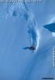
Time to do some hiking
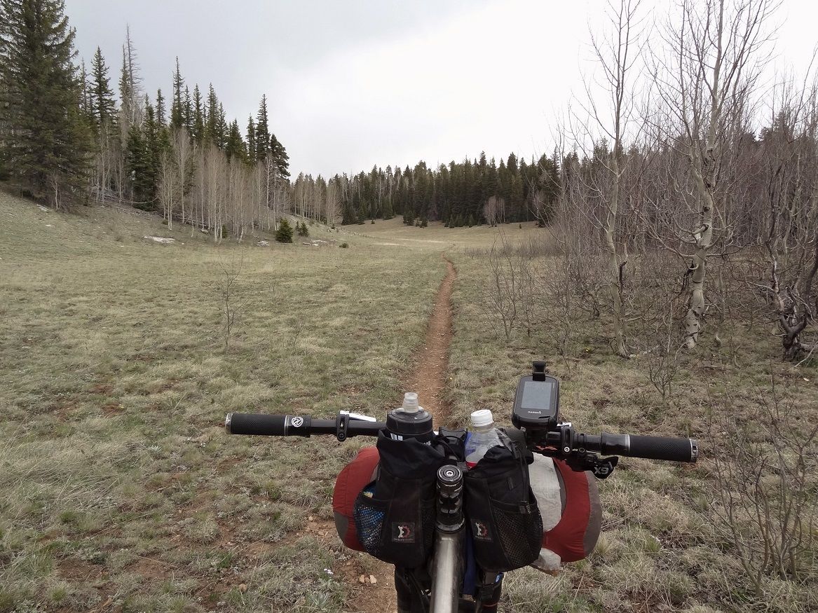
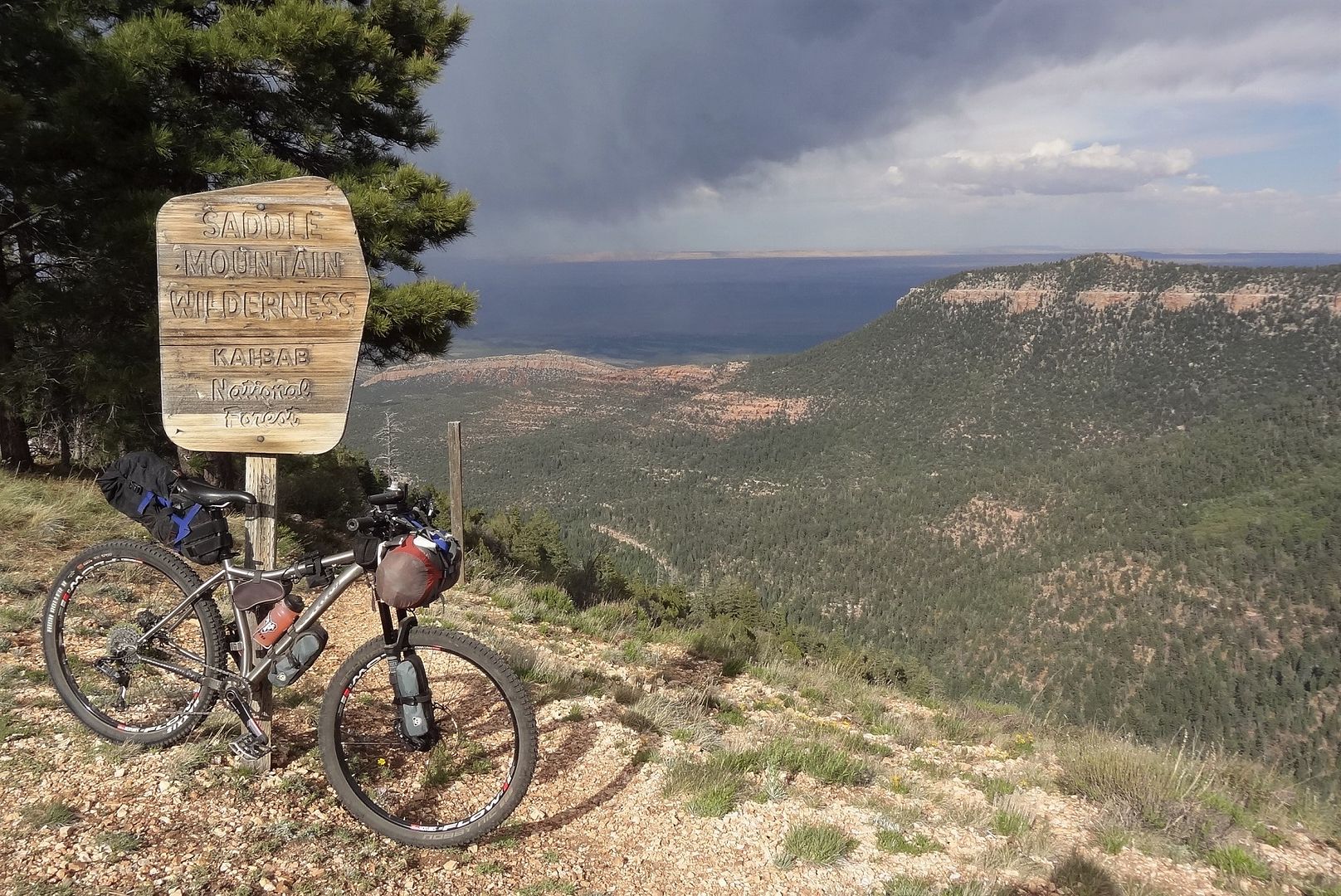
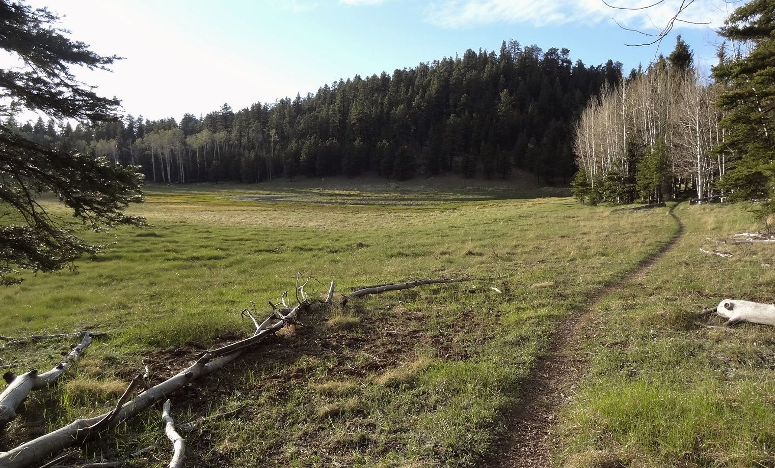
You never know what you'll find scouring topo maps and Schillingsworth found a cool trail, the Navajo Trail, that connected over this ridgeline to the AZT and beyond to some other dirt roads
It is far from being the easier option but I will never turn down singletrack if given the choice. A 700ft hike a bike was a nice break from the dirt road, til the elevation and heat started getting to me.
Almost at the top
The climb was slow because the trail was steep and hard to follow in places. Get slightly off track and you couldn't even see the trail until you zig-zagged across it or spotted a random cairn.
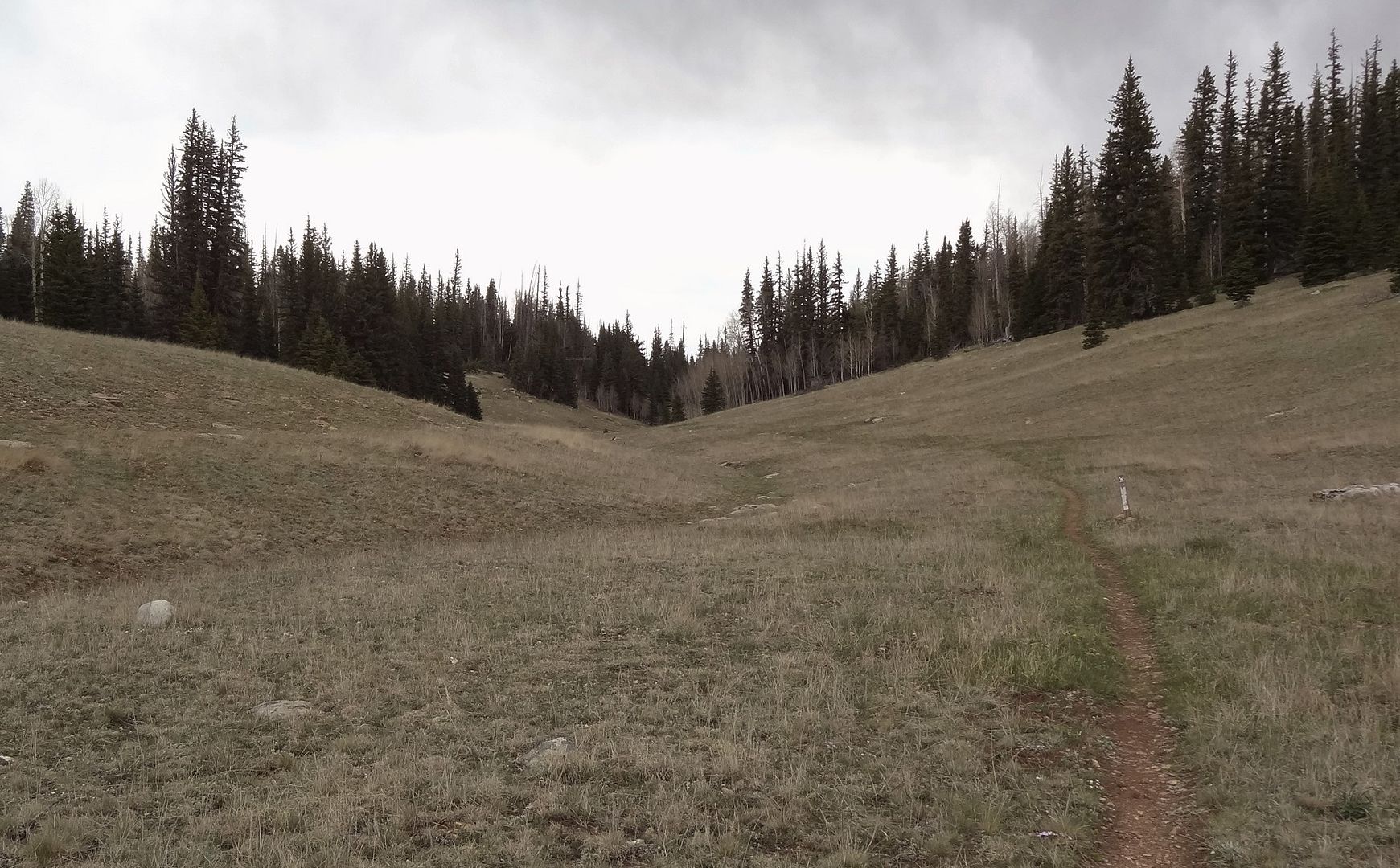
Once up top, the trail became just an open corridor for the most part. It was not overgrown at all, but there was seldom an obvious trail tread because of the total lack of traffic. After topping out it was pretty much all rideable.
There were occasional trail signs but in a number of open areas I had to rely on the GPS to keep me on route. You may survive without one but you'd better love trial and error.
The end of the Navajo Trail for me. As much as I wanted to check out the rest of it, I still had plenty of miles to go and didn't need any bonus climbing. Navajo continues another 6 miles including a 1200ft drop off the plateau.
Instead, I turned south on Forest Rd 248 which would take me right to Hwy 89 near Jacob Lake.
FR248 started off as doubletrack and slowly improved the more I climbed. Despite easy climbing I soon started feeling the first twinge of cramps. I couldn't remember the last time I had cramps after just 20 miles. I slowed down, drank more and made it into Jacob Lake around 230pm mostly unscathed.
Jacob Lake was a planned lunch stop and resupply, and I took a long rest to hopefully ditch the cramps. The toughest choice on the day was what do I hate more, cramps or pickles. Answer: cramps. Second question - can ketchup save the day? Answer: No!
The pickles and a couple hours of hydration worked and I had no more issues with cramps. I normally don't drink a lot on rides which was part of the problem. I did not want a repeat of that in the middle of nowhere so I bulked up with 250oz water, considering the next water source is 65 miles away. I also carried 2 days food in case I decided to skip the Grand Canyon village.
I wasn't on a schedule but was getting antzy to get moving because I'd have to make up any miles I didn't finish today. I left Jacob Lake around 530 still hoping to make it to the Rainbow Rim trailhead, that night 40+ miles away. That would be pushing it given the long break. Bring on the night riding!
A few last cool views before dark and the start of the climbing:
With some fast rolling forest road and a 2k foot descent, I covered 20 miles by dark. Around 9pm I suddenly had some major lightning strikes ahead, in the general direction I was heading. I stopped and had some food, watching the clouds to figure out if the storm was moving away or toward me. I had brought no rain gear as the forecast was 100% clear, so I needed to have some tree cover in case of rain. The clouds were moving favorably and within half hour the electrical storm blew over, so I kept going.
Temps were perfect and I was still feeling good. After the low point around 6,200ft I needed to climb back up to 8,000. Most of it wasn't bad, but the final climb would be a lot steeper on a more primitive road. I was ready to stop for the day but I turned into a frigid cold air drainage as I was looking for a campsite. No way was I camping there, I had to put on all my layers to keep warm despite the effort to climb. I finally made the top around midnight and had my choice of spots.
Another 16 miles after dark put me at around 68 on the day, and just 6 miles more of flat/downhill riding to the RR trailhead. I was pretty happy with that, and slept very well.
Results 1 to 24 of 24
-
06-21-2016, 12:14 AM #1

 Registered User
- Join Date
- May 2012
- Location
- People's Republic of OB
- Posts
- 5,251
TR - Bikepacking the Kaibab Plateau
Last edited by evdog; 07-04-2024 at 10:57 PM.
-
06-21-2016, 12:54 AM #2
Registered User
- Join Date
- May 2012
- Location
- People's Republic of OB
- Posts
- 5,251
Day 2
It would have been awesome to wake up along the canyon rim, but this campsite worked perfect, and it's not like I would be hanging out for long. I was rolling by 7am

I held off on breakfast til I hit the rim, thankfully it was a pretty quick ride to get there. Perfect, gorgeous morning too.

Self timer selfie

Bike shot fail

Rock out...

I started seeing a few people as I got near Fence Pt, and then a lot of people. The rest of the trail all the way past Timp Pt was a total zoo. Not a big deal, it was just a shock after seeing almost no one on the roads or trails that morning or the whole first day.

Most of the trail is good, some parts are what buff singletrack dreams are made of.


Probably the best view from the trail = great spot for a lunch break


The Forest Service is building a new extension to the RR Trail (see map http://a123.g.akamai.net/7/123/11558...LT2_058136.pdf) and I rode the first mile or so of that. Then it was back on fire roads the rest of the day.

My stretch goal for the day was to make it to the Grand Canyon Village. However, I also wanted to stop in and check out Point Sublime. My progress on the day would determine if that was worth it, as it is 6 miles off route and only worth it prior to sunset.
There were some nice sections of road to get there.

The National Park boundary arrived a lot sooner than expected

I ran into one park employee in a truck plus a couple side by sides in the afternoon. I saw no one else until Point Sublime

It is mostly downhill from the turnoff to the Point. This was good for making it by sunset, but bad for getting back on route.

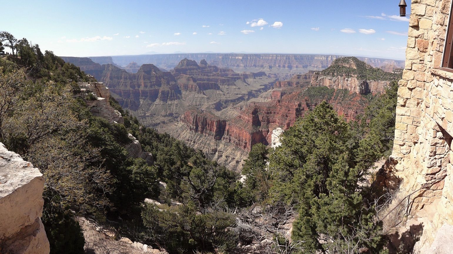
Point Sublime has one of the best views I've seen of the canyon

You even get a short glimpse of river

It would have been nice to see it in full daylight but the sunset was nothing to complain about
One of these times I need to come back and camp at Pt Sublime. The few people who were there all left at dusk so it would be pretty quiet.

I had dinner at the Point and then packed up at dusk and got back on the road. The climb back up to the turnoff was steady and not terrible. Past the turnoff the road seemed to alternate between cold air drainages and climbs up along steep side hills. I was getting ready to call it a night for but wasn't seeing any good camping spots. Finally after topping out at the high point I found a nice flat area next to the road. It was much warmer as well.
My mileage for the day was right around 60, and while I didn't make the village I was set up for a quick run in there in the morning. I slept well again.Last edited by evdog; 07-04-2024 at 10:59 PM.
-
06-21-2016, 11:48 AM #3

 Registered User
- Join Date
- Apr 2004
- Location
- Three-O-Three
- Posts
- 15,673
That's a hell of a Memorial Day trip... nice work! What were your thoughts on the Rainbow Rim trail overall?
-
06-21-2016, 11:51 AM #4
 Not on IR. For now.
- Join Date
- Jun 2006
- Location
- Couloirfornia
- Posts
- 8,874
Awesome ride!
 Originally Posted by Ernest_Hemingway

-
06-21-2016, 11:51 PM #5
Registered User
- Join Date
- May 2012
- Location
- People's Republic of OB
- Posts
- 5,251
Thanks guys!
Steve, its hard to say anything bad about a trail with sweet views into the Grand freaking canyon. RR is all about cruising mellow scenic xc, so don't expect any tech challenge, descents or climbing. A couple viewpoints are excellent but the rest aren't great as far as GC views go IMO - though you can hike down off trail for a better look. The trail itself is mostly buff xc riding and parts of it are amazing, through pine forest, meadows or along ridges. I like the section from Locust Point to Timp Point best, both for better singletrack quality and better views. It's ok from Locust to Fence Pt but north of there the trail has more punchy climbs and loose trail surface that can be a pain in the ass at elevation. Overall its a great destination ride, but hard to get to. Combine it with some sections of Arizona Trail and you've got a pretty good weekend. As far as bikepacking goes the possibilities are endless up there.
-
06-22-2016, 12:31 AM #6
 Registered User
- Join Date
- Oct 2009
- Location
- Maine Coast
- Posts
- 5,102
Really enjoyed reading your story and seeing the pictures.
-
06-22-2016, 01:04 AM #7
Registered User
- Join Date
- May 2012
- Location
- People's Republic of OB
- Posts
- 5,251
Day 3
I should say...I slept well, except for getting dive bombed by mosquitos all night...WTF, at 8400ft???
Again, I planned to hold out for a breakfast burrito at the Grand Canyon Village and was up early, rolling around 6am. The downside to the early start was freezing temps dropping down some drainages. All my layers on including knit cap under my helmet and cold weather gloves and I was still freezing. I barely warmed up enough on the climbs to recover for the next downhill.
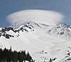
Proof of snow. The only white stuff I saw the whole trip. Unless you count frost I saw in some of the meadows.
By 730 it warmed up and I removed most layers.
One last climb to warm me up
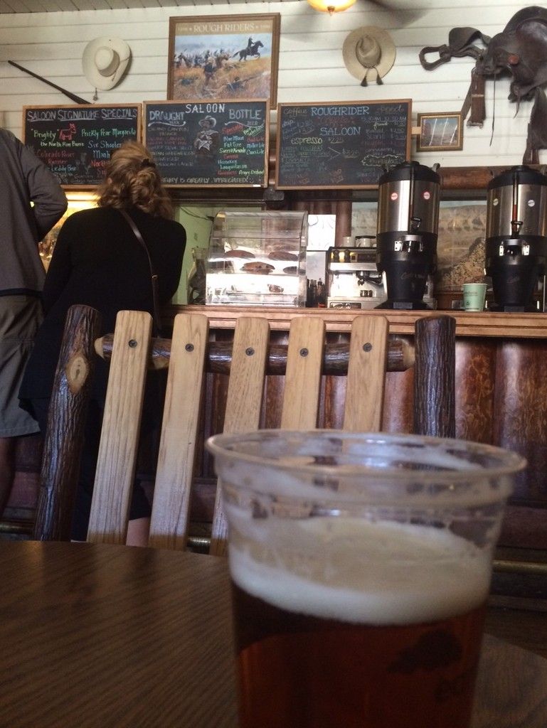
I rolled into the GC village around 9am. Wow, busy - tourists everywhere kitted out in their finest new hiking apparel.
The deli was closed until 10 so I headed to the Roughrider Saloon which serves breakfast burritos in addition to the token breakfast muffin fare. I had to wait as they were out of burritos. While I waited a joking inquiry led to the discovery that yes they can serve cold refreshing beverages at this hour. The burritos were not as large as I hoped so I loaded up on 2 more to eat later.
Beer for breakfast, because it is past noon somewhere...
I wandered over to the back side of the Grand Canyon Lodge to check out the view. Wish I had taken my burrito over there as they have rows of chairs to lounge in
The main trail through the park is open to bikes. I saw no one else on it, everyone was too busy driving the mile from the campground to the village. It's nothing special but has a nice grade and hey, its trail in a National Park that we're allowed to ride! How progressive...
I made my way back to the North Kaibab Trailhead, where that trail (also designated the Arizona Tr) climbs out of the ditch. Across the road it continues from there north, bikes are allowed. This has been a grey area as park plans haven't shown bikes as officially allowed, but signage and some maps do show bikes as allowed. A park plan update now underway is proposing to make bike access on AZT north of the rim official, as well as on a couple other routes in the park. Hopefully this trend continues and the parks start to allow bikes in more places.
After a short fire road section the real singletrack begins, with a lot of climbing. After a few miles it transitions into a utility corridor and has plenty of downed trees. This combo makes the section not much worth riding. I moved 15-20 smaller trees off the trail, but tons will need a chainsaw.
Typical section before it turns into full utility corridor
There were nine miles of this to get to the North Rim entrance station. Then another 4-mile dirt road climb up to a fire lookout. Skies were dark by this point and threatening rain so I considered skipping the lookout. In the end I made the short detour and climbed the stairs.
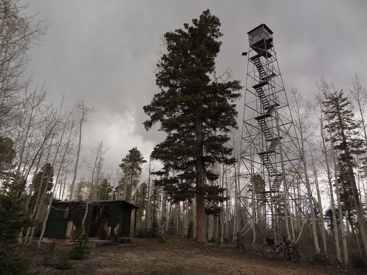
I was glad I did. On the way up it started to snow! Then it turned to horizontal rain.
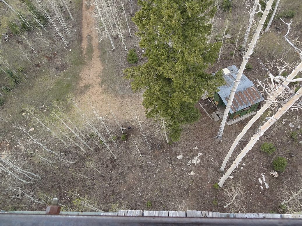
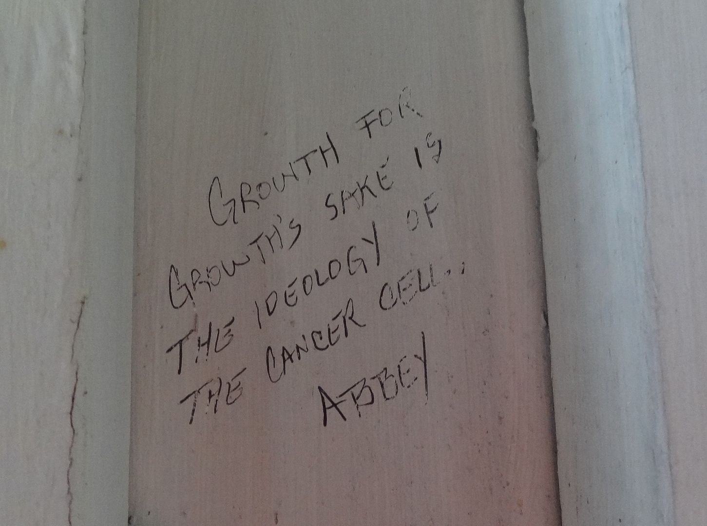
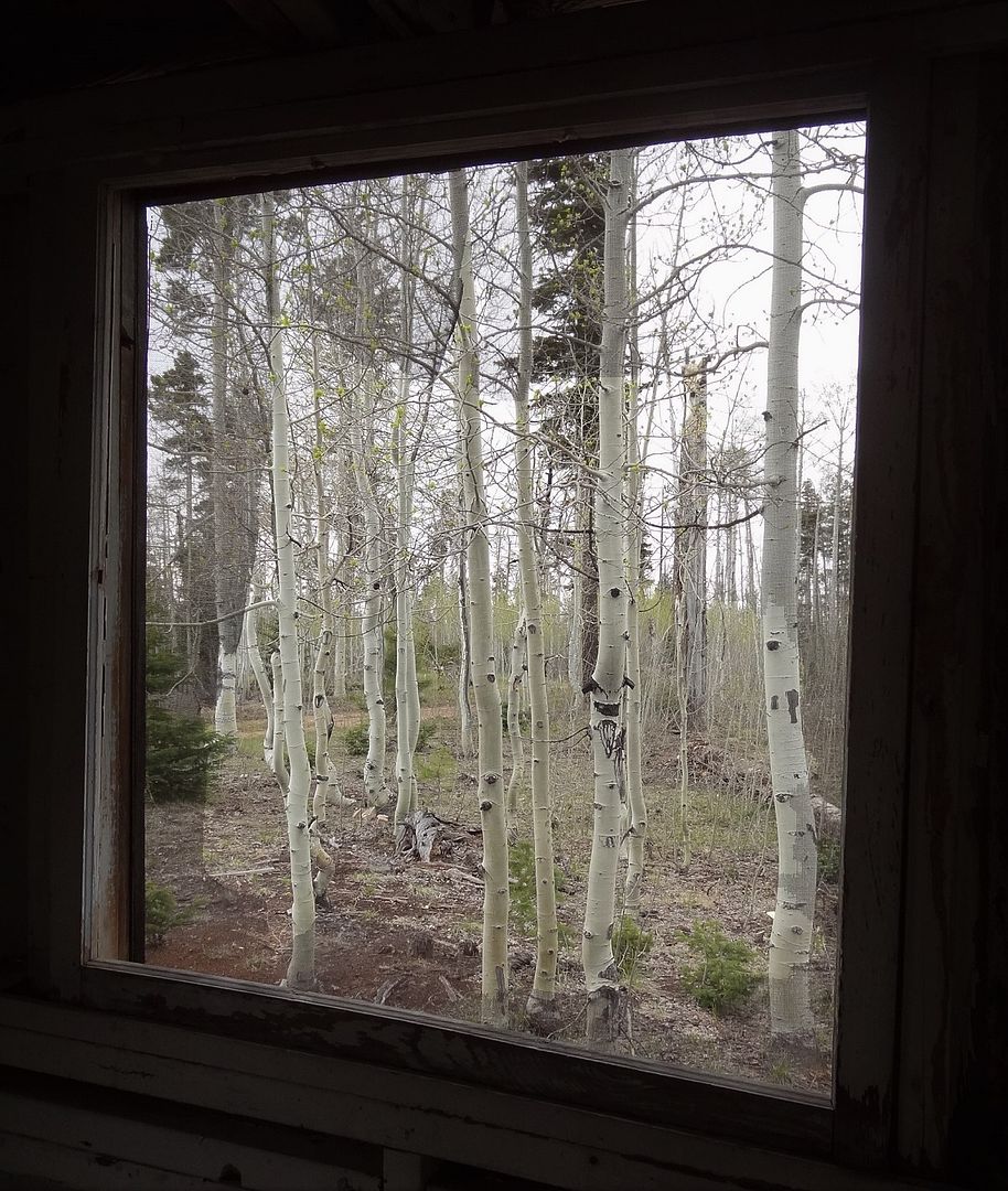
The cabin proved a convenient place to hole up for a while and gather my thoughts. Interesting graffiti inside. Abbey, apparently, manned the lookout tower for years and lived in this cabin.
View out the window
The day had gone a lot slower than expected thus far and it was now 3pm. With a 10 hour drive home waiting at the end of the trip I needed day 4 to be a short one, which meant a lot more miles of AZT today or possibly bailing on part of the ride. It sucks when you have just reached the section of trail you've been looking forward to most and have to consider bailing on some of it. As the rain continued self doubt creeped in and I was not liking my chances of getting far enough. There was 4.5 hours daylight left and 40 miles to Hwy 89. I needed to get close to there as the 27 miles from 89 to Stateline is said to take 6 hours. Not much I could do but refuel as I waited out the rain. After a few false stops it finally slowed, and I got going.
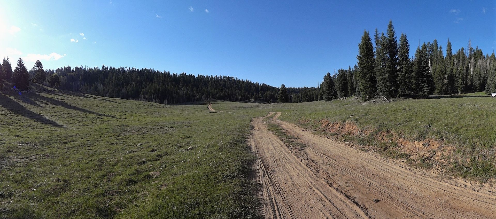
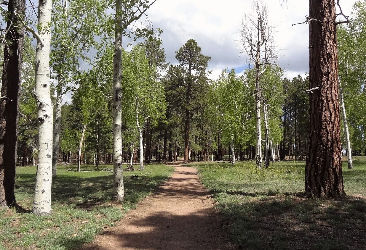
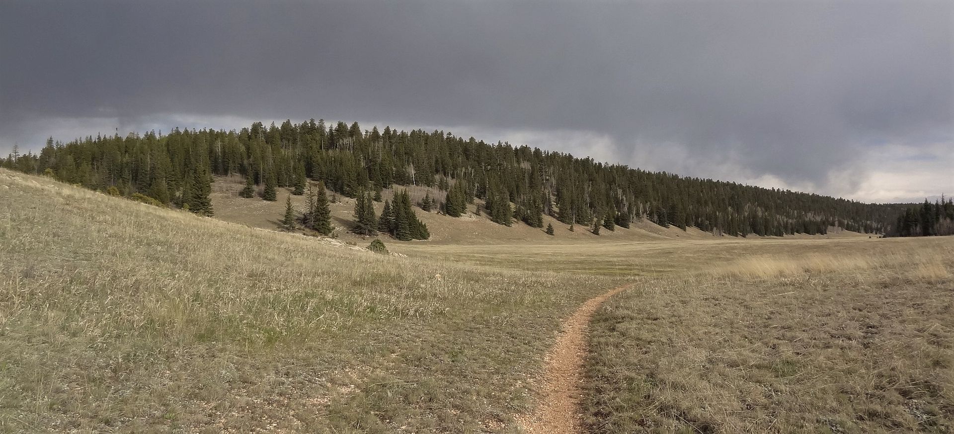
This next section of AZT is well known for gorgeous high altitude meadow riding.
But not on this day. I had hide out under trees a couple times as rain squalls passed through. The additional delays were not helping my concern over making distance
Soon enough though skies started to lighten up a bit and I was turning over some miles and getting into the rhythm - ride through meadow, hike a bike over ridge, descend, climb over downed tree, repeat.
There seemed to be a downed tree every time I picked up momentum. Not a huge number of them, but enough to be noticeable.
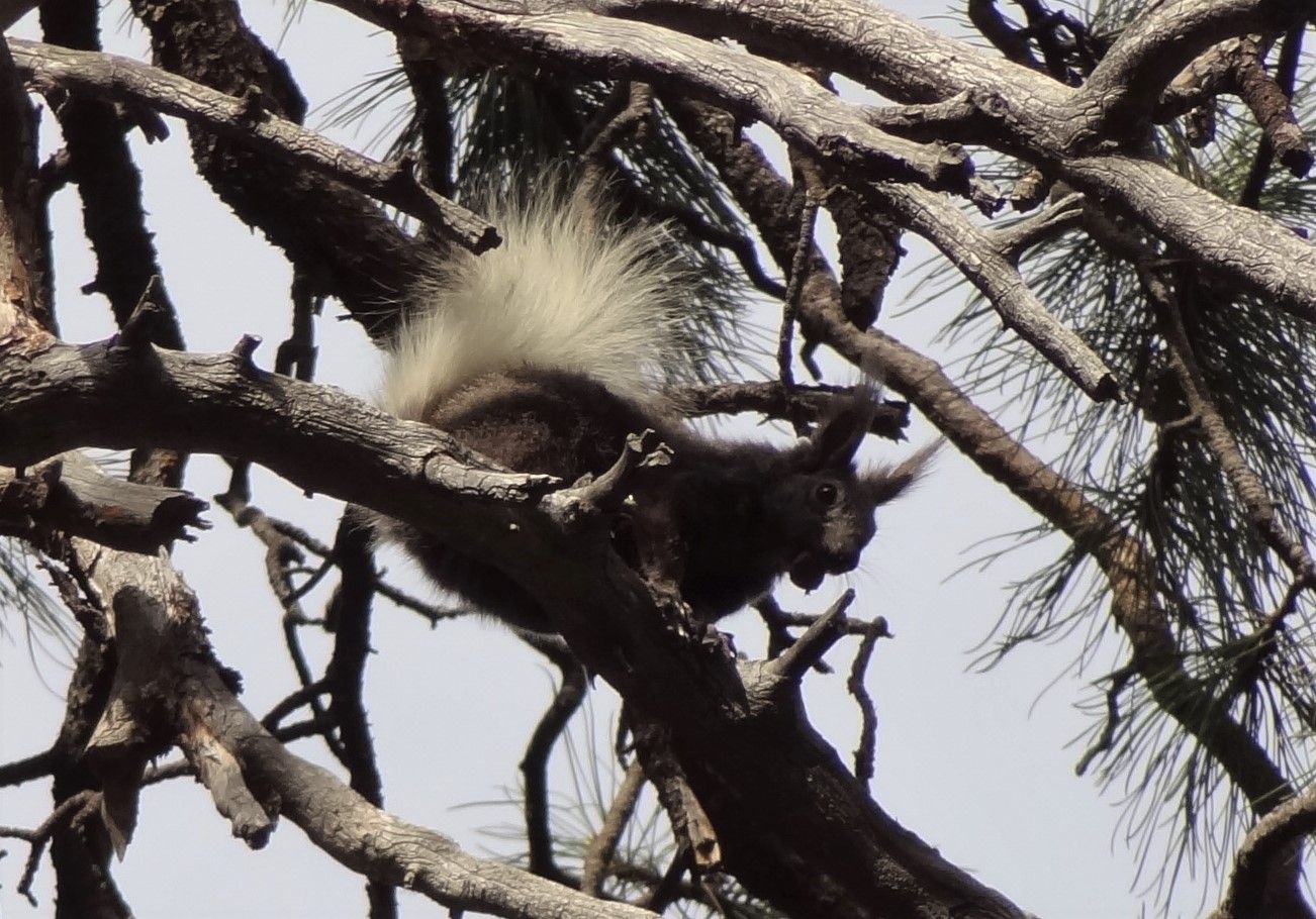
I also saw my first Kaibab squirrel. They are distinct with white tails and long pointy ears, and seemed more skittish (and harder to photograph) than regular squirrels.
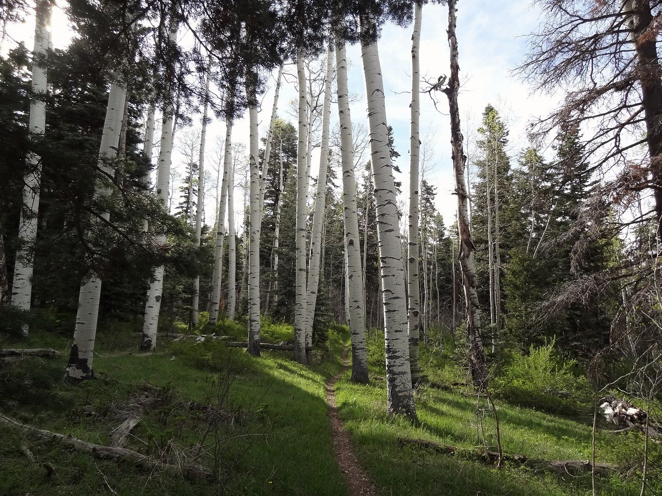
The trail got better and better as I continued on, with a few nice aspen sections. And another downed tree every 5-10 mins.
Eventually I got to the East Rim viewpoint. A trail drops down toward threatening clouds, but I continued on to the AZT.
More meadows. For awhile it looked like the storm behind this hill was going to pummel me, but as the meadow turned the clouds seemed to change directions and faded back for the last time.
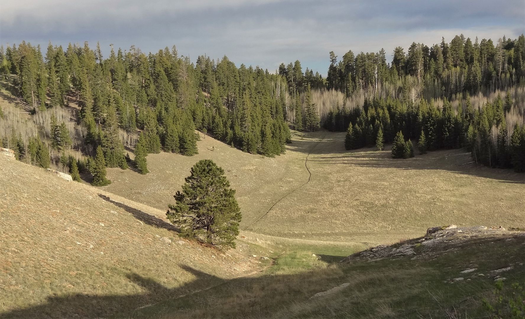
I still had more ridgelines to climb over as the meadow-HAB pattern continued. None of the climbs were long and they broke up the pace well so that I never got tired.
Getting close to sunset I came across this meadow with a small pond and some deer. One more 10 minute HAB followed, and at the top I stopped for my dinner burrito and got ready for night mode.
Last light
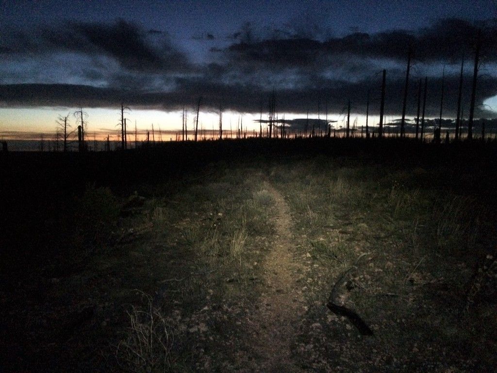
Beyond that high point the trail lead into a burn area and then an old road bed for a dozen+ miles of flat to gradual descent. The riding was just ok, and I doubt the views would be great so riding it at night was fine with me. It seemed to go on and on, and I figured if I could make it past the final HAB on the elevation profile I'd be in good shape for tomorrow. There were no big climbs after that so with a decent start time I should be fine.
The trail dropped into a final ravine before the HAB that was absolutely freezing cold. Climbing out of it I didn't find the tree cover I'd hoped for to provide wind protection but it was warm enough I just found a flat spot off the trail and crashed. At 50 miles I did well on the day considering the downed trees and rain delays. No mosquitos because of the breeze was a bonus.Last edited by evdog; 07-04-2024 at 11:01 PM.
-
06-22-2016, 10:01 PM #8
Registered User
- Join Date
- May 2012
- Location
- People's Republic of OB
- Posts
- 5,251
Day 4
The half-packed up campsite, and water boiling for breakfast. The distant ridgeline is what I rode along the night before

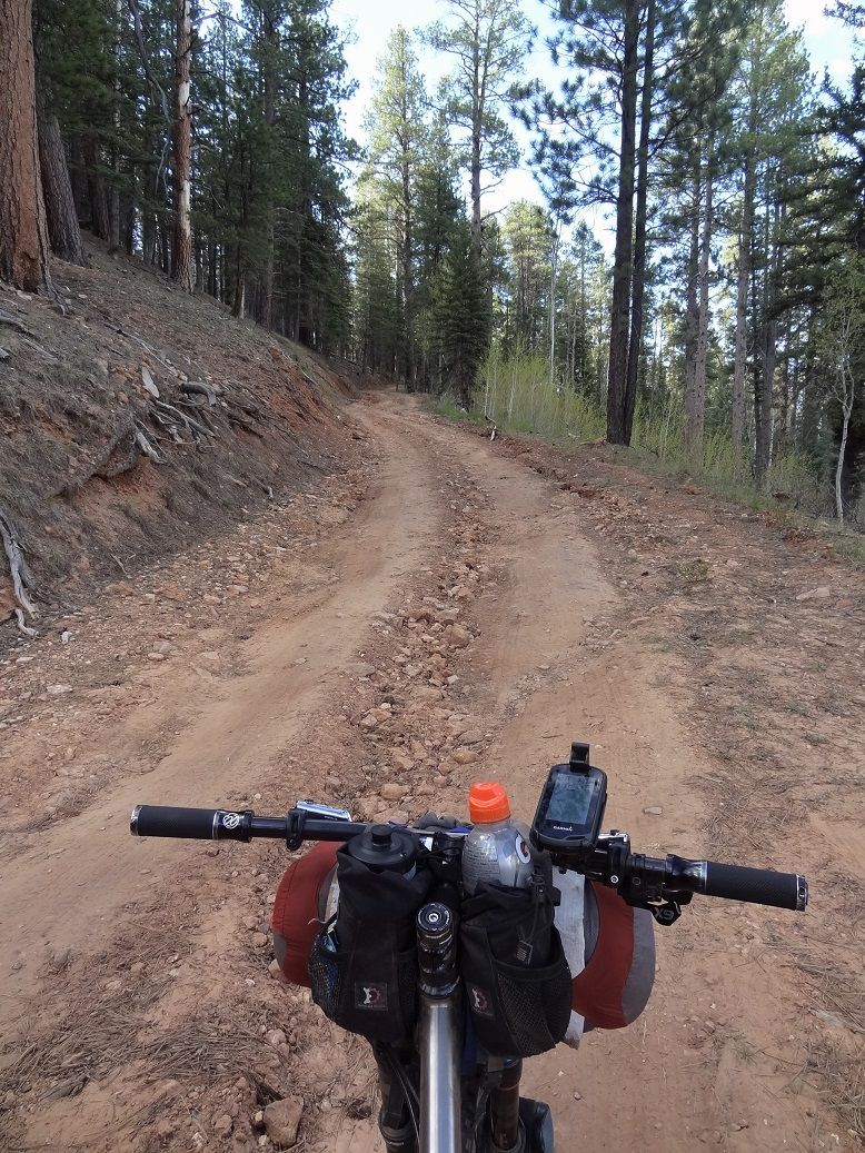
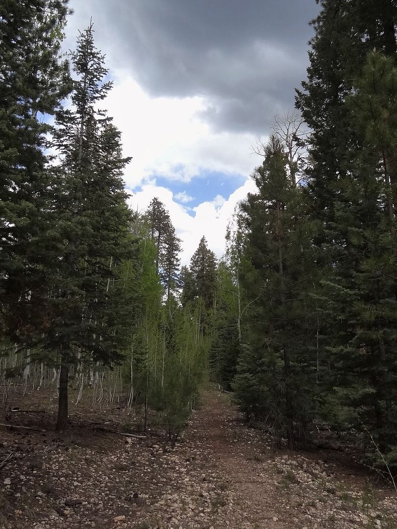
The old roadbed continued on for a couple more miles before finally climbing into tree cover

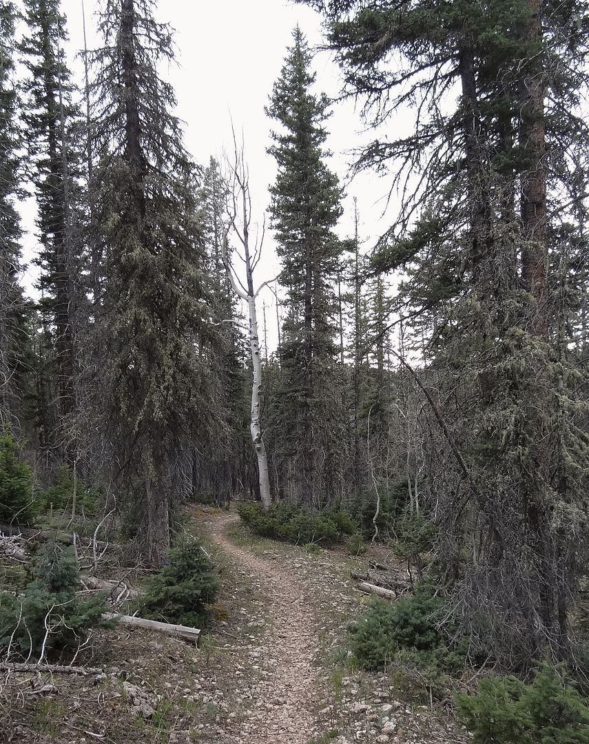
The road bed wasn't bad but there is no substitute for purpose made singletrack in the trees. The AZT here is the kind of riding I came here for

The trail was awesome for a few miles. Then it transitioned to double track, which was also awesome, as far as doubletrack goes

It took around 90min to hit Hwy 89, so I was a bit behind but on track to finish at a decent time.

As I continued on the trail slowly transitioned from pine forest to scrub brush

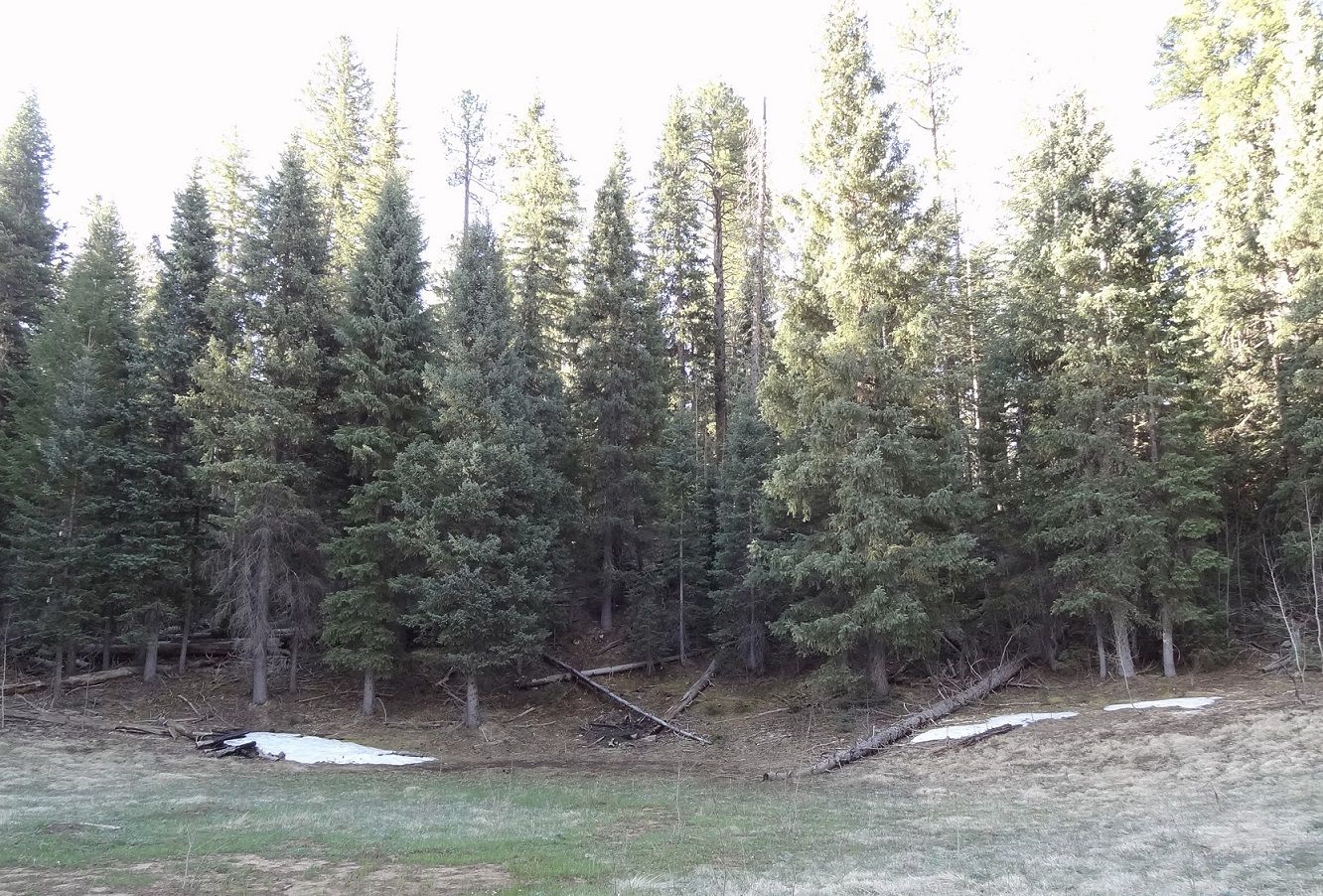
After a while I arrived at a meadow similar to the one I passed through on Day 1.

Hard to see in the first pic but you can make out the cliffs far to the north

AZT = Trail 101 = North Kaibab Trail

I started to see more flowers than anywhere else on the route so far. It seemed the higher elevations, while snow free, were still waking up from winter - still brown and barren

The trail continued its transition to Juniper and sage brush

And some cactus...

Mostly it was nice trail, a bit raw due to minimal traffic but some nice tech sections to break up the rolling terrain. And a few short HABs as the trail crossed some drainages

Getting more Utah-like

After crossing some drainages the trail finally started to follow one downhill

This dumped me out onto a ridgeline above the final switchback descent to Stateline

It was no Grand Canyon, but the views did not suck

Final descent. I'd call this day's ride a win, pretty nice trail for the most part and a great variety of terrain and scenery from start to finish. It dropped around 3500ft over 37 miles, mostly in 3 main descents, so it is definitely xc riding.

The horrible moment when you get back to the truck to find your soda exploded and your last two beers leaking bubbles.

Fortunately the salvage operation was successful, and after cleaning up I was on the way home. This sign makes more sense for those who reach the campground via the AZT:

Kinda sketch way to ride. But the dog was stoked, ears dancing in the wind.

I made it home pretty late but the long hours driving and riding were well worth it. I covered a lot of nice terrain, rode some amazing trail segments, and saw a ton of cool stuff. Nothing like some long days riding your stress away....Last edited by evdog; 07-04-2024 at 11:04 PM.
-
06-23-2016, 01:31 PM #9
 Registered User
- Join Date
- Jan 2008
- Location
- Paper St. Soap Co.
- Posts
- 3,640
Awesome TR and riding! Would be interested to see a map view of the route. Your timer photo on the rim reminded me of a photo I took of you back in 2010:

-
06-23-2016, 01:46 PM #10
Registered User
- Join Date
- Apr 2006
- Location
- SF & the Ho
- Posts
- 10,892
+1 on route map. Nice TR
-
06-23-2016, 01:57 PM #11
 Registered User
- Join Date
- Oct 2003
- Location
- slc
- Posts
- 19,215
Amazing, 11/10!
-
06-23-2016, 02:36 PM #12
 Agent of Tang
- Join Date
- Sep 2005
- Location
- Not in the PRB
- Posts
- 34,562
did I already post in this thread? Can't recall. Either way, sweet! and thanks for sharing.
"fuck off you asshat gaper shit for brains fucktard wanker." - Jesus Christ
"She was tossing her bean salad with the vigor of a Drunken Pop princess so I walked out of the corner and said.... "need a hand?"" - Odin
"everybody's got their hooks into you, fuck em....forge on motherfuckers, drag all those bitches across the goal line with you." - (not so) ill-advised strategy
-
06-23-2016, 03:15 PM #13
 *NOT* an expert
- Join Date
- Oct 2003
- Location
- 9,300ft
- Posts
- 23,134
very nice! I almost want to bike pack
Originally Posted by blurred
-
06-23-2016, 03:42 PM #14
 Registered User
- Join Date
- Dec 2005
- Location
- Glasgow, UK
- Posts
- 1,321
Awesome!
-
06-23-2016, 04:10 PM #15
 Registered User
- Join Date
- Jul 2005
- Posts
- 1,820
These TRs are inspiring. I'd love to consider these types of trips but don't think I could ride half these distances with just a camelback. No chance w/ all that shit strapped to my bike/back.
-
06-23-2016, 04:37 PM #16
Registered User
- Join Date
- May 2012
- Location
- People's Republic of OB
- Posts
- 5,251
You might surprise yourself. Keep in mind I was riding from around 7am to midnight so that factors in a lot to the distance covered. I am not a fast rider or in great shape, I just plug along at cruising speed. As long as you take in enough water and food you can ride a long time. Butt soreness is often a more limiting factor for me, and part of the reason I stop often for a minute to rest or take pics. It also helps a lot of the distance was dirt roads, they can take a lot less energy than singletrack. The biggest limitation when bikepacking is not being able to drop the seat for descents. Otherwise I only really notice it on steep climbs or really technical trail. It is barely noticeable for normal pedalling. Originally Posted by rudy
No strava for me but I'll see about getting a map up.
-
06-23-2016, 04:47 PM #17
 truckin'
- Join Date
- Dec 2006
- Location
- crown of the continent
- Posts
- 13,945
A truly awesome TR. thanks a ton.
Something about the wrinkle in your forehead tells me there's a fit about to get thrown
And I never hear a single word you say when you tell me not to have my fun
It's the same old shit that I ain't gonna take off anyone.
and I never had a shortage of people tryin' to warn me about the dangers I pose to myself.
Patterson Hood of the DBT's
-
06-24-2016, 09:40 AM #18
Registered User
- Join Date
- May 2012
- Location
- People's Republic of OB
- Posts
- 5,251
Here is a map link. Supposedly there is a way to embed an interactive map but I can't get it to work.
https://ridewithgps.com/trips/9617604
-
06-26-2016, 05:15 PM #19
 goes bananas
- Join Date
- Oct 2008
- Location
- the desert
- Posts
- 883
Bravo! I still haven't gotten up there, and I live in AZ..
For those of us that are not bikepack equipped, is it possible to drive in closer, out-and-back or shuttle some shorter sections, like maybe from the top of the fire lookout to the east rim overlook?
-
06-26-2016, 10:34 PM #20
Registered User
- Join Date
- May 2012
- Location
- People's Republic of OB
- Posts
- 5,251
Definitely possible. AZT stays pretty close to the highway and there are plenty of access points. From fire lookout to east rim overlook would only be around 10 miles but you could easily go further.
-
06-27-2016, 02:27 PM #21
 Wax on, scrape off ...
- Join Date
- Mar 2007
- Location
- Eugenio Oregón
- Posts
- 8,858
Sweet adventure! That's one big ass loop you did.
My fiance and I did a bit of out and back riding around there this last October. We had a lot more fun on the RR side than the AZT on the East Rim side. I'm stoked about the new extension to the RR trail._______________________________________________
"Strapping myself to a sitski built with 30lb of metal and fibreglass then trying to water ski in it sounds like a stupid idea to me.
I'll be there." ... Andy Campbell
-
07-07-2016, 08:22 PM #22
 Registered User
- Join Date
- May 2009
- Location
- BFE
- Posts
- 573
Very nice trip write up. I've ridden Rainbow Rim numerous times and except when I got rained out, it is always a delight.
-
07-08-2016, 09:39 PM #23
 Registered User
- Join Date
- Sep 2005
- Location
- Canadian Rockies
- Posts
- 1,086
Wow! Unreal...You and I would get along just fine...Thanks for sharing!
-
07-17-2025, 09:02 PM #24
click here
- Join Date
- Oct 2008
- Location
- valley of the heart's delight
- Posts
- 2,600
Nice ride. The high plateau is beautiful country.
10/01/2012 Site was upgraded to 300 baud.


 Reply With Quote
Bookmarks