
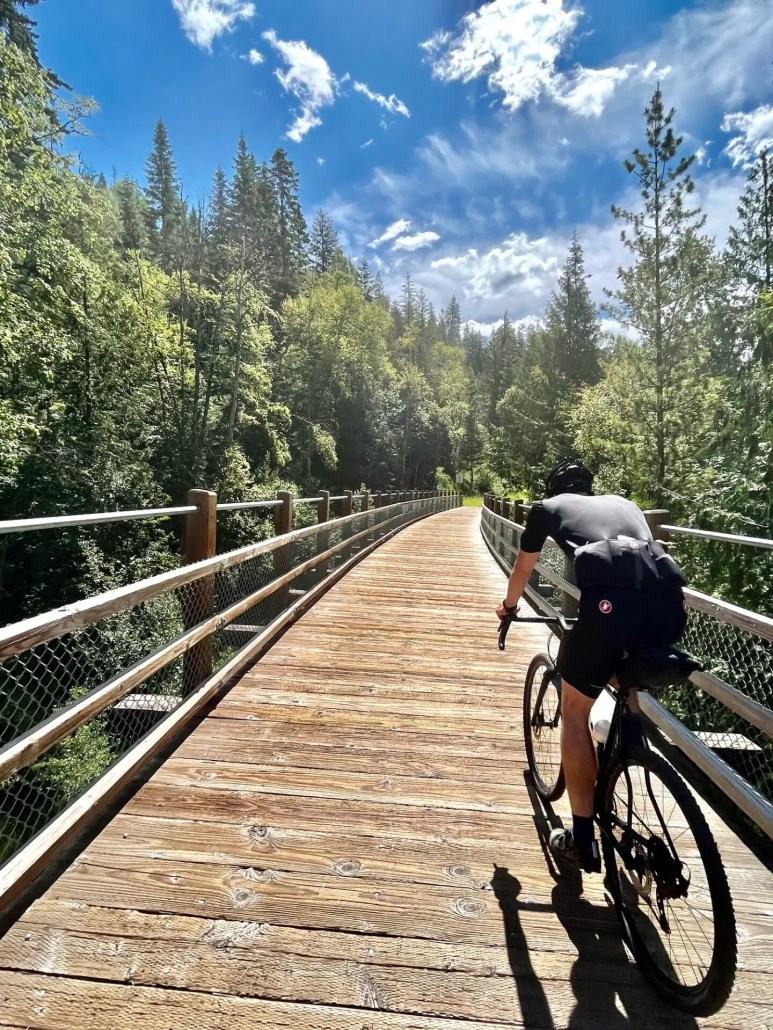
This summer, I am going to share one ride a week to show what incredible gravel riding we have here in the Kootenays. Hopefully, it will give folks some ideas for some great Kootenay bike adventures. I’ll try and cover the whole spectrum from mellow cruises to a bit of gravel esoterica.
GLACIER CREEK GRAVEL rideGlacier Creek FSROut and back rides aren’t my favourite, but this one is quite spectacular. The views in both directions are top notch and the nice thing is you get a different perspective as you ride in and out.
Meadow Creek is a small community perched between the south end of Duncan Lake and the north end of Kootenay Lake, really it’s the confluence of the Duncan River and Kootenay River. There are a few places to stay in the area, such as the municipal campground in Meadow Creek or the BC Rec Sites on Duncan Lake. The Meadow Creek store has a selection of food, but your best bet is to stock up in Kaslo before you head north.
Heading into Meadow Creek on Highway 31The forestry industry is in full swing in the area, so be aware of logging trucks. Bringing a VHF radio programmed with the Resource Road Frequencies is not a bad idea. Also, Meadow Creek is pretty remote for southern BC, it’s a small community in the heart of the Columbia Mountains, there’s all sorts of wildlife including bears, cougars, deer and elk, so be prepared to take care of yourself, pack a first aid, a solid repair kit, plenty of food and clothing.
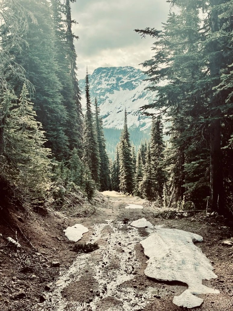
Svein Tuft enjoying some of the views on the way up Glacier Creek.We started the ride from Meadow Creek and headed south on Highway 31 and turned east across the Duncan River on the Argenta Road. From there we headed north on the Duncan FSR until we turned east onto the Glacier Creek FSR. After a short steep climb, the road gradually climbs its way up the valley for 26.5 km to the Jumbo Glacier Trailhead with a vertical gain of roughly 1200m.
There are a number of extra add-ons that you can do to gets some cool views of the surrounding mountains. I’d suggest doing them if you have the chance. The views for the Monica Meadows trailhead are particularly nice. The climb up there packs a bit of a punch.
The climb up to the Monica Meadows Trailhead
A nice spot for a snackThe road has a fair bit of undulations, so you get a bit of reprieve from the climbing and descending on both legs of the ride.
We tacked on a bonus climb up towards the Lavinia Lookout on our way out. The first few kms are nice steady climbing, but then the road gets steep and loose. After 90km and 2500m of climbing we decided to pull the plug and head back to Meadow Creek, making it a 118 km ride.
Looking NE up Duncan LakeThat’s the tip of the iceberg for riding in the area. There are plenty of roads to explore, though not a lot of loops. We rode the Howser Ridge loop the day before, which is a worthy ride, though it’s not all high speed gravel. There are some steep over grown sections and other sections where folks have brushed the road and laid the alder on the road bed.
The Howser Ridge LoopFor weather I like to use SpotWX as it provides numerous models and localized forecasts.
The Lardeau River
Results 1 to 12 of 12
-
06-16-2024, 11:11 AM #1
 Registered User
- Join Date
- Sep 2022
- Posts
- 113
Ride of the Week: Kootenay Gravel 2024
-
06-16-2024, 11:26 AM #2
 Tweezer Reprise
- Join Date
- Jan 2010
- Location
- Walpole NH
- Posts
- 11,392
That first picture looks fake it’s so good, I’ve never seen like that!
crab in my shoe mouth
-
06-16-2024, 11:42 AM #3
 Steezus Christ
- Join Date
- Dec 2005
- Posts
- 12,290
With the seemingly endless spectacular terrain coupled with the relatively low population and distance from major urban centers you Kootenay area denizens are spoilt! Keep the photos/reports coming.
-
06-16-2024, 11:50 AM #4

 Registered User
- Join Date
- Jan 2016
- Location
- Greg_o
- Posts
- 3,001
Nice data and great pictures. I'm towards the other side of Canada but I've been through Kaslo visiting Trail where my father grew up. Really love that area and need to get back there sometime.
-
06-25-2024, 09:08 AM #5
Registered User
- Join Date
- Sep 2022
- Posts
- 113
THE THREE RANGE ROUTE
 Climbing up Springer Creek The Three Range Route is an incredible gravel ride through the Kootenays and links up the Slocan, Kokanee and Bonnington Ranges. This 175 km loop with 5000m of climbing over a variety of surfaces is sure to provide an incredible adventure. Feasibly it can be done as either a one or two day trip as both Nelson and Slocan are cool places to hang out and swim for an afternoon.
 Black Prince Pass and Arlington PeakI left Slocan at 0615 on a cool late June morning started the ~1300m climb up Springer Creek. The first six kilometers are relatively steep and then the grade relaxes a bit. Snow was lingering on the last 100m or so of Black Prince Pass, so a short bike carry was obligatory.
 Looking south down Crusader CreekLater in the summer, it’s possible to stay high through the pass and get a better view, but due to the snow, I stayed low and opted for snow free travel. It’s a loose and relatively rough descent down to Lemmon Creek and the Six Mile Lakes junction.
 A freshly graded Six Mile Lakes RoadThe ride past Six Mile Lakes winds it’s way through some old growth cedar groves along a sinuous road. It plunges steeply down to Kootenay Lake on the east side of the pass.
 The BOB— the gateway to Nelson from the North Shore.After three and a half hours of travel, I stopped into Oso Negro for a sandwich and a coffee and met up with my buddy Julien. The terrace and the entire cafe at Oso are truly a work of art—one can see how it’s a community hub for Nelson. From there, we climbed up to the Great Northern Rail Trail and followed it to Highway 6. We crossed it and got onto the Giveout Creek FSR.
 Julien on the rail grade The Giveout Creek FSR climbs into the Bonnington Range where there’s an incredible network of logging and old mining roads to explore. I followed the Giveout Road up to the Gold Creek Road to the old Silverking mine site below Toad Peak. The fun part about the climb is you can look back to the the Kokanee Range and see where you’ve been.
 Toad Peak
 Looking north towards the Kokanee RangeThe roads wind their way around the north flank of Bonnington Range. Their quality ranges from high speed gravel to single track through alder tunnels. Just the type of adventure I sought!
 One of several creek crossings along the way.
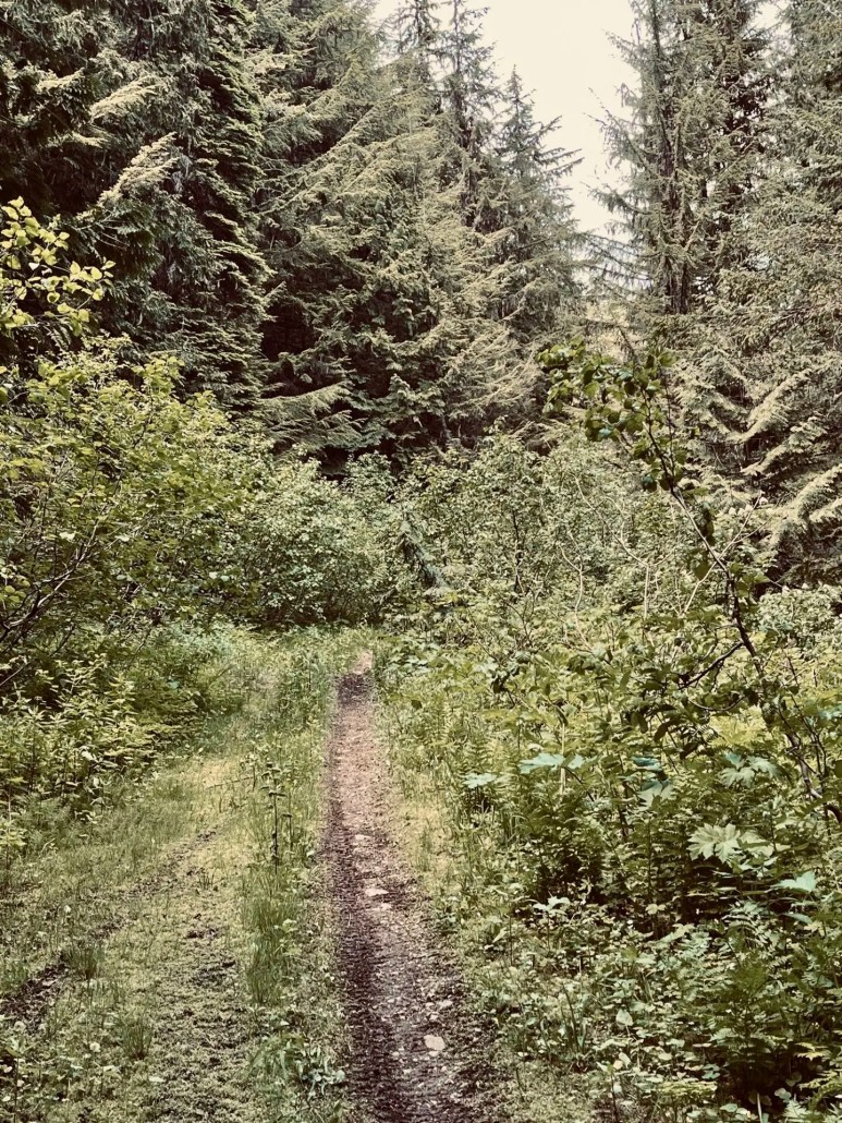 An awesome single track climb.After rambling around in the Bonnington Range, a high speed, yet chunky descent pours you out in Blewett. A silky rip on pavement takes you further down to the Kootenay River and across the Taghum bridge.
 Climbing up Sproul CreekSproul Creek is one of my favourite climbs in the area, as you start on pavement, transition to a trail along Sproul Creek and then onto a beautiful gravel road that yields phenomenal views of the Bonnington Range.
 Sproul Creek Gravel
 Looking south towards the Bonnington RangeOnce you crest the pass, the road undulates its way down to Pedro Creek and yields excellent views of the Valhallas
 The ValhallasThe descent down Pedro Creek is steep, chunky and loose at times—a real brake screamer. It dumps you out just south of the unincorporated community of Winlaw. The across the road is the Slocan Rail Trail, which can be followed north to Slocan.
 Slocan Rail TrailThe unsettled weather throughout the day persisted as I hit the Slocan Valley. A block head wind out of the north was the icing on the cake. I needed to get home in time for dinner, so I chose the smooth pavement of highway 6 to make some time. This route is definitely one to consider if you’re interested in a real Kootenay adventure biking experience. Drop a line if you’d like a GPX file for this route.

-
06-25-2024, 12:07 PM #6
 Maniacally smart!!!
- Join Date
- Mar 2011
- Location
- Magically whisked away to...Delaware
- Posts
- 3,617
OH MY!!! These photos are BONKERS!!!!
I think I need to move!It makes perfect sense...until you think about it.
I suspect there's logic behind the madness, but I'm too dumb to see it.
-
06-25-2024, 04:04 PM #7
 tree junkie
- Join Date
- Dec 2006
- Location
- bestcoast
- Posts
- 2,181
SOLID! sick route
-
06-25-2024, 09:16 PM #8
Steezus Christ
- Join Date
- Dec 2005
- Posts
- 12,290
Those photos are the best “excuse” one could ever use for “why get a gravel bike?”
-
06-26-2024, 07:48 PM #9
 Registered User
- Join Date
- Aug 2007
- Posts
- 812
Gravel/bike pack thread, Jong!
Kidding. A couple of stunning loops over there. Would be keen on trying the three range one of these days. Will try to get one or two others and might check in with you for the route. Happy to trade information on Okanagan loops with a similar style.
Sent from my iPhone using TGR Forums
-
06-26-2024, 10:19 PM #10
Registered User
- Join Date
- Sep 2022
- Posts
- 113
I am always happy to share some beta, send me a DM or an email and I’ll send you a GPX file for the route. Glad to see some other people stoked on rides like this. What’s a Jong anyway?
 Originally Posted by alive

-
07-03-2024, 10:53 PM #11
Registered User
- Join Date
- Sep 2022
- Posts
- 113
VALHALLA/RUBY RANGE GRAVEL
 The 17km 1250m descent into the Slocan Valley The Ruby Range lies at the north end of the Valhallas, it’s home to an extensive forest service road and ATV trail network. In my opinion, it’s some of the best riding in the Central Kootenays.
 High speed climbing I’ll put a caveat on that statement in that you must like riding uphill to truly enjoy the riding in the Ruby Range. Over the past couple of days I’ve amassed 168kms and 6220m of climbing while exploring the Ruby’s. I’d also like to acknowledge the Nakusp/Arrow Lakes ATV club and its volunteers for all the trail maintenance they do. It really is a gem what you have going on, thanks for all your work.
 The trail map at Bonanza CreekThe Shannon Creek FSR is one of the best climbs in the central Kootenays. It gains roughly 1250m over 1700m to the Shannon/Caribou Pass. The surface is relatively smooth and the grade is amenable to flowy climbing. It’s been my access point the past couple of days and the descent is exceptional too.
 Columbia River views on the west side of the range.
 A bit of gravel esoterica in the North Valhallas It’s also the final climb of the Valhalla Circumnavigation Route.
 The final grade up to the Shannon/Caribou PassWhile you find plenty of high speed gravel, there’s also a fair bit of loose and rough terrain, some bike pushes, LOTS of Wildlife and an extremely remote feel. Be prepared with everything you need to fix yourself or your bike and ride with a buddy. For those who like to mix a bit of VTT into their gravel routes, I’d highly suggest the moto-bypass back to the Shannon FSR. It’s a sinuous, loamy double track that will keep most people entertained.
 Moto By-pass Satellite imagery is quite useful for plotting routes in this area, as a lot of the roads aren’t on most mapping apps. The ATV trail map is also a great reference
 The Sisters trail
 Looking down on Summit Lake
Last edited by Arctos Guides; 07-04-2024 at 07:45 AM.
-
07-08-2024, 09:30 PM #12
Registered User
- Join Date
- Sep 2022
- Posts
- 113
THE VALHALLA-RUBY TRIPLE CROWN
 The 1300m first climb of the dayThe Valhalla-Ruby Triple crown is a quintessential Kootenay gravel adventure loop. Over the course of roughly 130km it climbs through three passes for a total of 4000m. The fun part about this loop is it has plenty of options for camping if you’d like to do it as a multi-day trip. For the day trippers, there’s tons of creeks for water, but no food options, so pack a heavy lunch.
 Descending into MacDonald CreekThis ride is truly a backcountry adventure; once you head up the Shannon Creek FSR, you’re questing off into the puckies. The remote feel of the ride is fantastic.
 Looking towards what’s to come.The first pass is a steady climb of 1300m to a pass which brings riders down an old road now ATV track into the Columbia River Valley aka the Upper Arrow Lake. After a sinuous descent to 600m, the route climbs steeply back up to 1600m.
 Excellent views up the Columbia.
 The road turns into an ATV trail as it crests the ridge into the Caribou Creek drainage.The ATV track is steep and requires a bit of bike pushing, but the forest through which it travels is spectacular. The upper part of the descent is bushy, but it opens up after a couple of kilometers and transcends I to high speed gravel.
 Looking south in Caribou CreekAfter another mega descent, the road immediately climbs up the south side of Caribou Creek. The climb is a consistent grade with a few steeper sections.
 The final pass of the ride is on the looker’s right of the photo.
 Black bear in the Center of the photo.Steadily the road contours the south side of the drainage and grinds its way up the valley. At one point it drops steeply down to Caribou Creek where the Arrow Lakes ATV club has a bridge that links to the road on the north side of the creek.
 Caribou BridgeThe signage for the ATV Routes is fantastic and is a great reference for route finding along the way. After crossing the creek, the road continues to climb its way up the the final pass at 1800m. Some of the grades are my favourite in the Kootenays, as they lend themselves to big ring climbing with great views along the way.
 Climbing up Caribou Creek
 Skiing anyone?
 The descent back to Hills.All said the Valhalla-Ruby Triple crown is roughly 130km and 4000m of climbing. For me it ticks all the boxes of a backcountry gravel ride.


 Reply With Quote
Bookmarks