
Great idea, but yes, best of luck getting the gov to do anything productive within a 3 year period (things will sit on desks for weeks waiting for one signature before repeating the process over and over and over).
Plus, stinky hippieswill throw a fit
, get a petition, and then the econazis will force all kinds of ridiculous assessments to go down as a result "(like, omigod, the mariwanna smoke will totally fumigate the valley during the morning inversion man, and the net ecosystem productivity could decrease man, as a result of decreased stomatal function. Like whoa man, that will contribute to climate change too, whoa.").
Better idea?
Build it somewhere secret and write up your antidisestablishmentarianistic behaviors as super-postmodernist rebellion of active youth, complete with photo documentary.r:
seriously tho, contact rick poetke about your idea, he does a lot with local gov
Anyways...hoping a nice project will go down on tha Eastsyyyyd in coming days. finish with an onsight of Knucko's Pride of jah North if all goes well mmmhmm WOO WOO
have fun in the big hills kidz stay safe burn with solar irradiance while the optical depth is low (EVERYBODY loves Beer's Law)
Results 26 to 50 of 439
-
01-04-2011, 11:01 PM #26
 so funky fresh
- Join Date
- Jan 2009
- Location
- on tha eastside
- Posts
- 209
-
01-04-2011, 11:07 PM #27
 Registered User
- Join Date
- Jan 2010
- Location
- Small Sky Country
- Posts
- 546
I know I simply am just delighted and looking forward to dealing with the government and have heard of the equally as fun stinky hippy crowd. Id rather go the legal route just because I am tired of getting in trouble with rangers. Thanks a lot for the contact though!
These are the general areas ive looked at with apparently great fireroad access. Feel free to share your insight if you have ridden in those areas
Onida Lake
Copper Mountain/Virginia Lakes area
Green Creek, you can get far up the valley before you hit wilderness
1 mile north of tamarack lake
Near Sawmill ridge
Near Rickey Peak
Near Mt Emma
Near Leavitt Lake (lots of sleds I know but wilderness boundary is very close)
The northside of 108 from leavitt
North of the USMC base
I pretty much looked at topo maps and just put down points on every drainage from sorta 120 to above 108. I honestly have no idea if any of these places will work, they just looked cool in TR's, in pictures and on topo maps
Also sorry for unstoking this thread, here is some last year Eastern Sierra Stoke


Last edited by stoepstyle; 01-04-2011 at 11:18 PM.
-
01-04-2011, 11:52 PM #28
 Not on IR. For now.
- Join Date
- Jun 2006
- Location
- Couloirfornia
- Posts
- 8,874
stoepstyle,
If you need any help on the dental end of things, some of us dentists do various types of regulatory work.
If the ultimate hut site is near a climbing objective, my buddy Brian (also a dentist) is the executive director of the Sacramento area Access Fund-affiliate--which is probably the closest AF-affiliate. He's an avid splitboarder as well.
You *might* be able to get Snowlands or the AAC to help sponsor/get some positive press as well. Originally Posted by Ernest_Hemingway

-
01-05-2011, 01:04 AM #29
 Registered User
- Join Date
- Jun 2010
- Posts
- 171
Great idea.
Google Yurts in Montana, they seem to allow them there.
-
01-05-2011, 11:19 PM #30
Registered User
- Join Date
- Jan 2010
- Location
- Small Sky Country
- Posts
- 546
Awesome! Thanks for the information. Ill keep it in mind Originally Posted by LightRanger
-
01-06-2011, 11:49 AM #31
 Don't Panic
- Join Date
- Jun 2006
- Location
- Ventura Highway in the Sunshine
- Posts
- 22,445
Glad to hear a "little bureaucracy" is not deterring you. It is a great idea, and something the east side would benefit from.
I agree it is a constitutional right for Americans to be assholes...its just too bad that so many take the opportunity...iscariot
-
01-06-2011, 08:50 PM #32
32 degrees + Precip=Magic
- Join Date
- Nov 2008
- Location
- Tahoe
- Posts
- 88
Stoked to see what you get into 213

Skied Mini Pinner in glorious pow yesterday after a late start. North Face everything is ridiculous down there right now.
A shredder crew nailed Mendenhall and left some nice tracks.
Heading back down in the a.m. No need to post pics from our Coke Chute mission prior to this storm (forgot about this thread) but if you want to check some early Plateau pics out go to unofficialnetworks.com and find the State of the Backountry 2010-2011 Edition: III
The snow in Tahoe is so good right now and Pow on the Eastside is just unreal Enjoy all and be safe! Here's a few from Mini Pinner
-
01-12-2011, 12:13 PM #33
32 degrees + Precip=Magic
- Join Date
- Nov 2008
- Location
- Tahoe
- Posts
- 88
Mt. Whitney and Crater Crest
-
01-12-2011, 02:31 PM #34
so funky fresh
- Join Date
- Jan 2009
- Location
- on tha eastside
- Posts
- 209
High winds kept us from primary objective, so we skied some off the wall stuff that will now enhance the laugh factor during subsequent drives.
Near Paradise:

Also skied a 3000ft tree run of fine windblown on sunday near Crowley, nice to have a storm-ski option in the memory bank now!
Keep yo headz up, near-miss in LVC:
http://www.esavalanche.org
-
01-20-2011, 09:54 PM #35
Registered User
- Join Date
- Apr 2004
- Location
- South Lake Tahoe
- Posts
- 3,618
any updates on conditions? Is there any pow/winter snow left on north facing stuff? Is any south facing stuff corning up, and up to what altitude? Hows access on buttermilk road to Basin and points further afield?
Sorry for all the questions, I am heading down there next week.
-
01-21-2011, 11:09 AM #36
 Registered User
- Join Date
- Jun 2006
- Location
- Pleasuretown
- Posts
- 1,095
Anyone been out on the east side? I'm heading out tomorrow and have all these same questions. Originally Posted by harpo-the-skier
-
01-21-2011, 11:16 AM #37
sick, spiteful, bad liver
- Join Date
- Nov 2005
- Location
- underground
- Posts
- 935
mostly hard snow high, corny show lower, with maybe small patches of isolated softer snow tucked away in obscure places. Some breakable crust of varying thicknesses is far more common. The Buttermilk area is pretty well melted out, but I doubt you can drive far toward Basin regardless; snow is hanging on in shady areas. Originally Posted by harpo-the-skier
-
01-21-2011, 12:28 PM #38
Registered User
- Join Date
- Jun 2006
- Location
- Pleasuretown
- Posts
- 1,095
That is pretty much what I imagined. I'm more concerned about the approach to the high, north facing stuff, but don't really want to wait around for sun to start softening things up. Hmmm... decisions.
-
01-21-2011, 01:05 PM #39
sick, spiteful, bad liver
- Join Date
- Nov 2005
- Location
- underground
- Posts
- 935
a nice source of information, including specific routes and conditions--
http://esavalanche.org/
-
01-21-2011, 01:44 PM #40
one of those sickos
- Join Date
- Oct 2005
- Location
- Tahoe-ish
- Posts
- 3,357
We tried to ski Tom last Saturday and turned around about 1/3 of the way up due to horrible, variable conditions. It ranged from bulletproof winslab to stiff sastrugi, to breakable crust on the N-NE faces we were ascending. Our plan was to head down there again this weekend, but with somewhat colder and windier conditions forecast, I'd be really surprised if anything is worth skiing. Perhaps a bit of corn below 9k, but that's not really why we go down there, is it?
ride bikes, climb, ski, travel, cook, work to fund former, repeat.
-
01-23-2011, 07:17 PM #41
Registered User
- Join Date
- Apr 2004
- Location
- South Lake Tahoe
- Posts
- 3,618
I am looking for an Eastside Sierra Touring Partner wens 1/26 and thurs 1/27. I will be looking for corn but can't promise we will find it. You probably need boot and/or ski crampons, ice axe would be nice but I have a whippet you could borrow. I will be camping out. PM me or leave a note on this thread.
-
01-25-2011, 03:15 PM #42
 Because I'm a caveman....
- Join Date
- Oct 2008
- Location
- NorCal
- Posts
- 2,569
Eastside Ice TR. May as well try to bump this thread with some kind of stoke (even if non-skiing). Note: there are some Dana and Bridgeport beta shots at the end.
TR: Eastern Sierra Ice Climbing – Lee Vining Wall & Horsetail Falls
Dates: January 22-23, 2011
Climbers: Enginerd, Dynosaur, Harpo-the-Skier & UCL
Locations: Lee Vining Caynon, Main Wall & June Lake, Horsetail Falls
Video & Photos: UCL (unless otherwise noted)
Synopsis: We headed down to the Eastside over the weekend to take in some Sierra ice climbing in Lee Vining Canyon and Horsetail falls. Lee Vining Canyon Main Wall was in good shape with thick ice and cold temperatures on Saturday. On Sunday, we headed down to Horsetail Falls in the June Lake area. Unfortunately, recent warm weather and sun exposure from the prior week had melted out many of the flows and the ice was fairly hollow. Alternatively, we hiked around to a North-aspect, mini-flow and worked on ice screw placements, anchoring, etc…
All in all, a great weekend of climbing with a good group!
This TR contains both a Video TR and Photo TR.
VIDEO TR
A full video TR of the weekend, complete with soundtrack. HD version can be viewed directly on Vimeo.
PHOTO TR
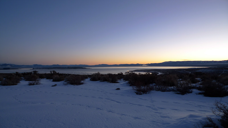
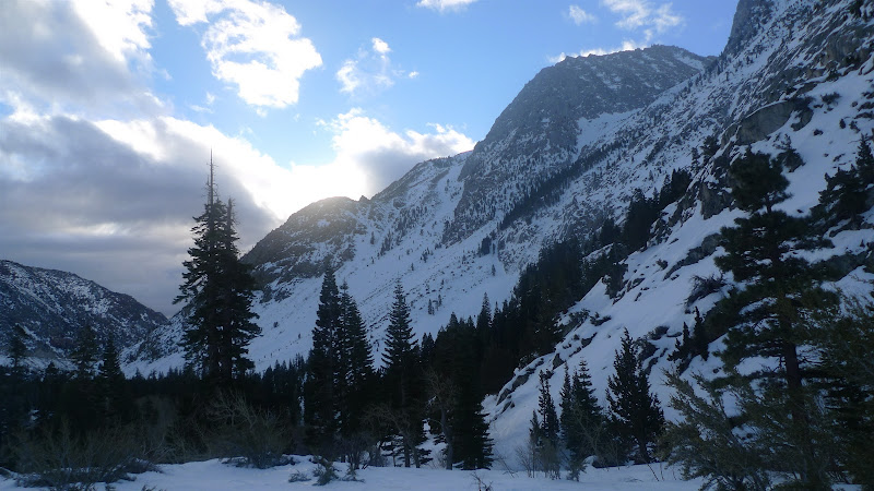
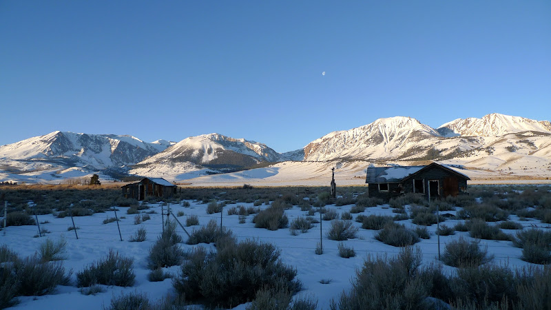
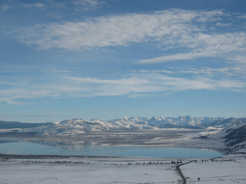
To start off, Enginerd and Dynosaur found a pretty awesome campsite on a fire road with spectacular views of Mono Lake to the East, and the Dana Plateau to the immediate West. All of the shots below are from Sunday morning, with first light of the daybreak following a day of climbing in Lee Vining on Saturday. Sorry the TR is out of order, but I really wanted to start with these scenic shots to capture the beautiful area that is the Eastern Sierra.
Sunrise over Mono Lake from our campsite at around 6,500 ft.
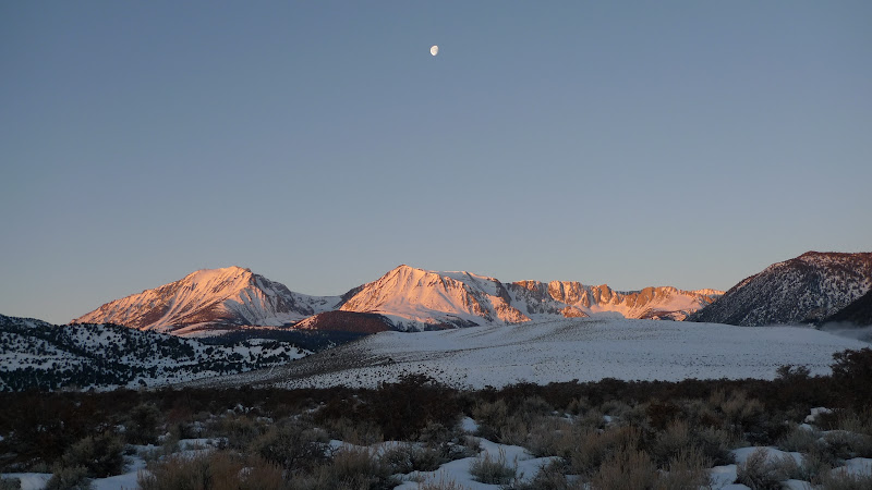
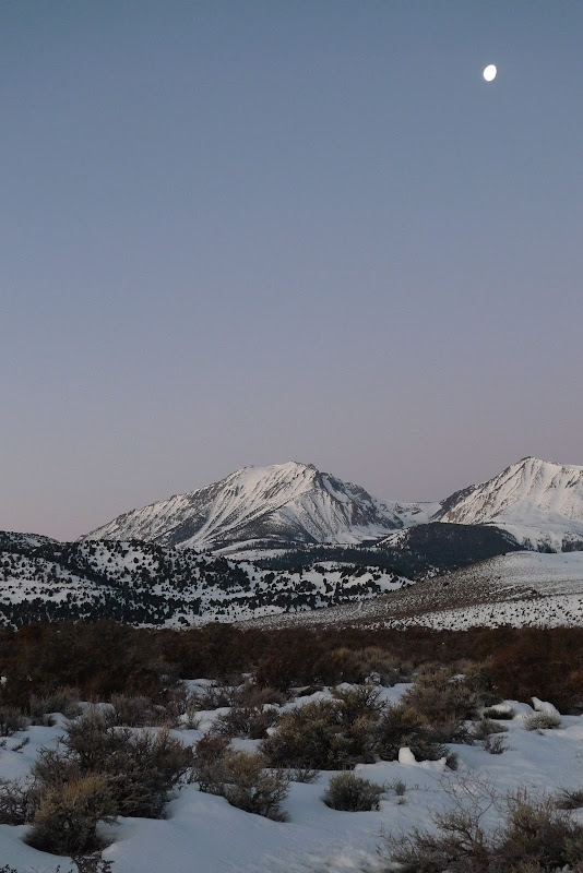
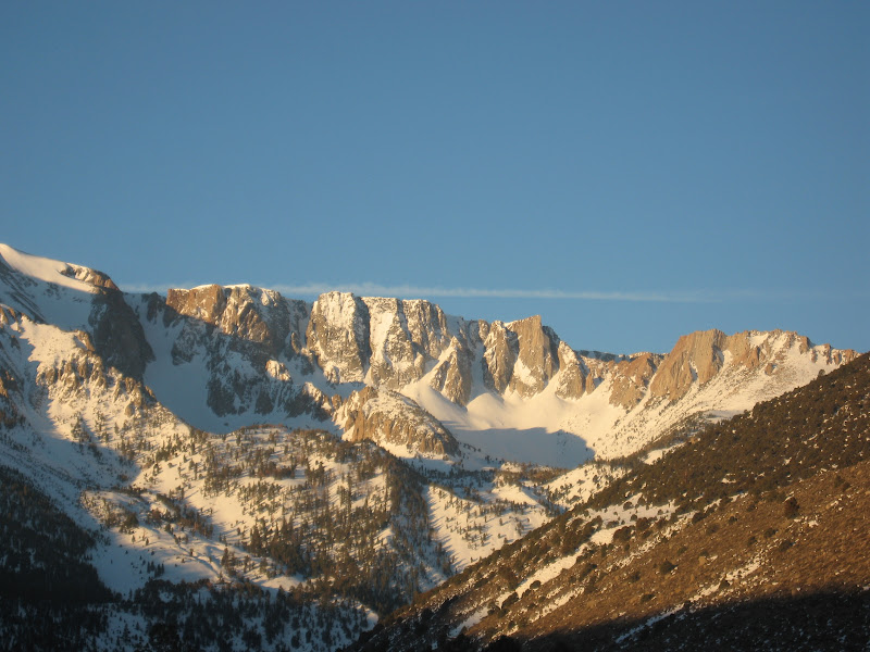
First light hitting the Dana Plateau, with the moon lingering above.
The stillness of the high-altitude desert along 395 with the High Eastern Sierra peaks is always breathtaking.
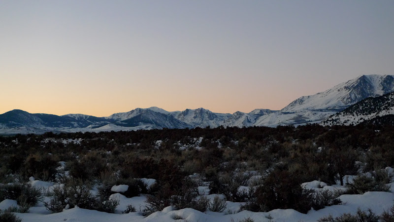
First light hitting down South towards the June Lake area.
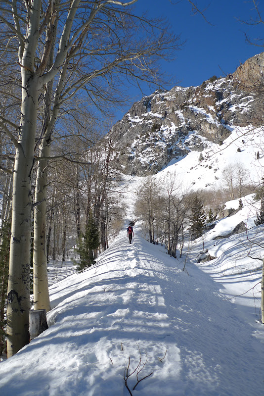
The trail to Lee Vining Canyon was in great shape Saturday morning, with a hard-packed boot pack making for very quick approach conditions. We made it from the power plant to the base of the Main Wall in just under 30 minutes, give or take.
The Baird-Harrington Wall looked like pretty thin ice and well above the pay-grade of any member on our team (perhaps maybe Enginerd). I will leave that to the true adventurous alpinists!
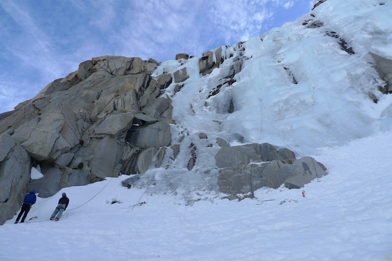
Looking up to the Main Wall and Chouinard Falls further, respectively. Both were very fat ice and in good condition. While Chouinard Falls was very crowded later in the day, we shared the Main Wall almost the entire day with only one other party of three.
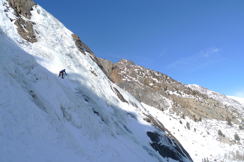
Enginerd with the first lead of the day on the Main Wall, towards the immediate left of the center flow.
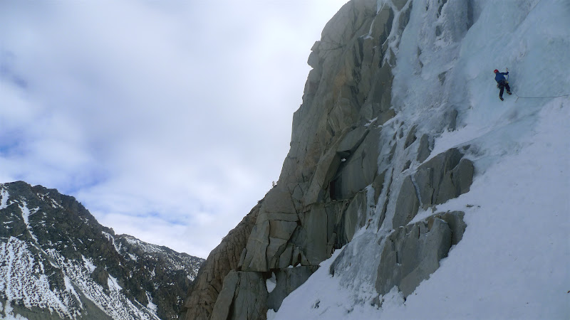
Enginerd leading the furthest left flow on the Main Wall, which we top-roped for a while before pitching out to the top.
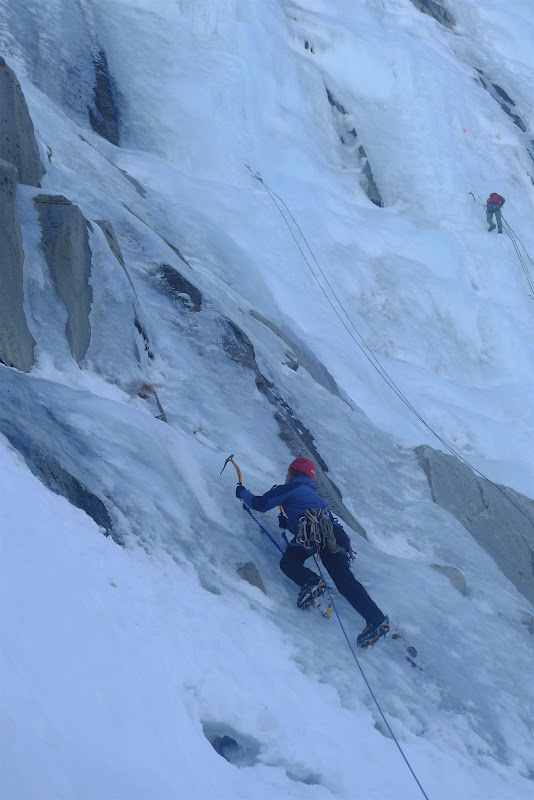
Looking at Enginerd and the other party on the Main Wall, with the Chouinard Falls off in the distance.
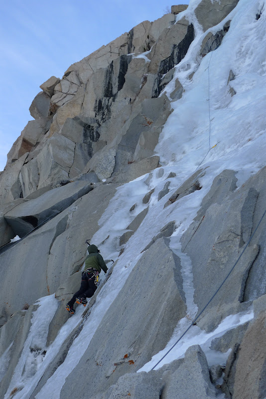
Enginerd working up higher on the left-most flow, which offered some good ice next to rock (and some fun mixed moves for Harpo-the-Skier, Dynosaur and I when following).
Note that most of the above photos are a little blurry as my lens was fogging up and I didn’t notice until about now (hence the pictures subsequently clean up a bit). Same concept in the movie – oh well, I will be sure to check more in the future.
Harpo-the-Skier in a fun section of a narrow ramp of ice through the rock portions.
Dynosaur higher up, working towards the first pitch anchor.
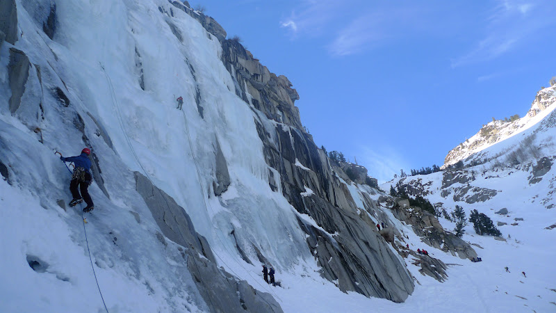
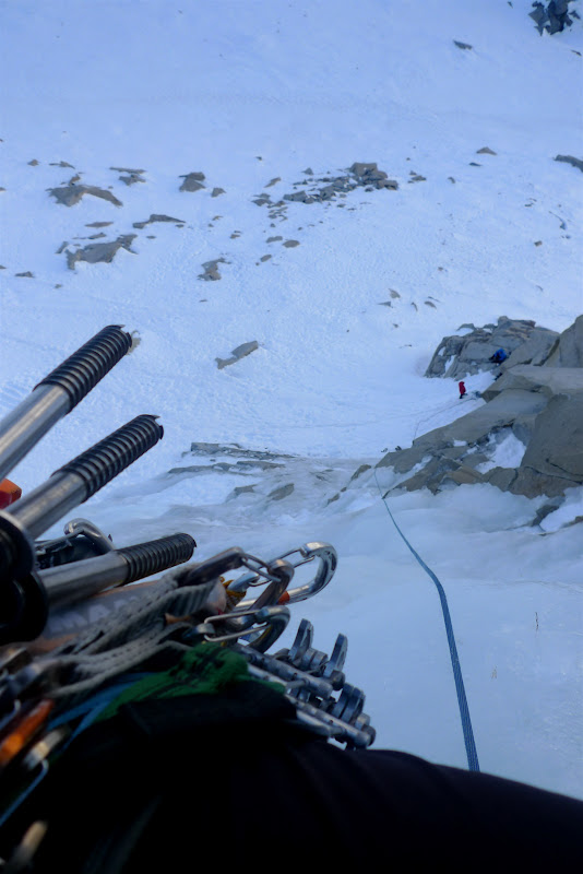
Here you can see the two ropes that we set up on the left portion of the wall. The right top rope was set with two 60M ropes, and the left with two 70M ropes. We each climbed several routes off these anchors throughout the day. Towards the end, Enginerd, Dynosaur and I climbed to the anchor on the left rope, and then Enginerd led a second pitch to the top over the cool and thick vertical ice flow in the upper left of the picture. A really impressive lead by Enginerd!
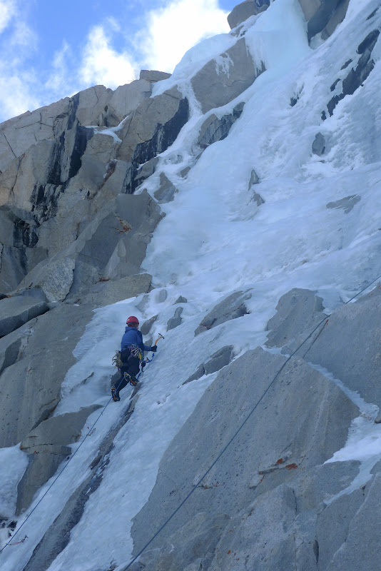
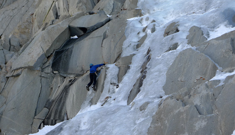
Here I am working a really fun thin ice section on top rope. It was fun to have a top rope in this section, so we could test climbing in some thinner ice sections with some fun mixed rock moves. Photo: Enginerd
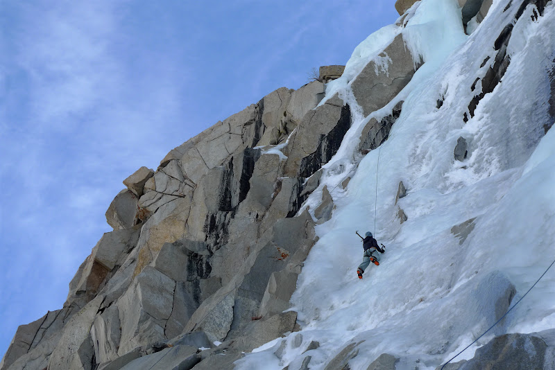
Looking down from the anchor on Pitch 1, as Enginerd was leading up to Pitch 2 on the left-most flow. You can see me down in my red jacket for perspective.Photo: Enginerd
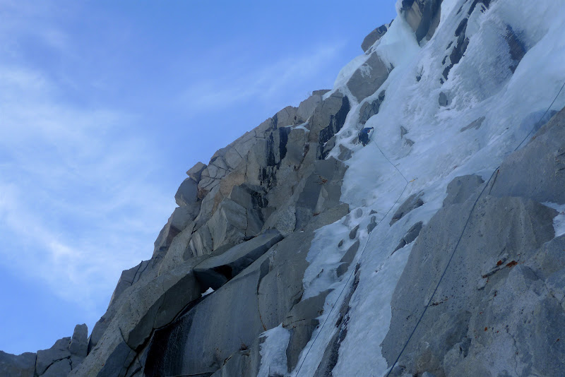
Enginerd leading the crux of the second pitch – a really cool ice flow. More impressive was that Dynosaur followed with only one ice tool! We won’t get into the specifics of why she only had one ice tool at that point, but needless to say, I think she now appreciates the benefits of the leashes/umbilical cords Enginerd, Harpo-the-Skier and I were using Photo: Dynosaur
Note: Once again, my camera was wet! Ugh.
After a great night’s sleep on Saturday night and waking up to the views of Mono Lake and the Dana Plateau that I posted above, we decided to head to Horsetail Falls at June Lake.
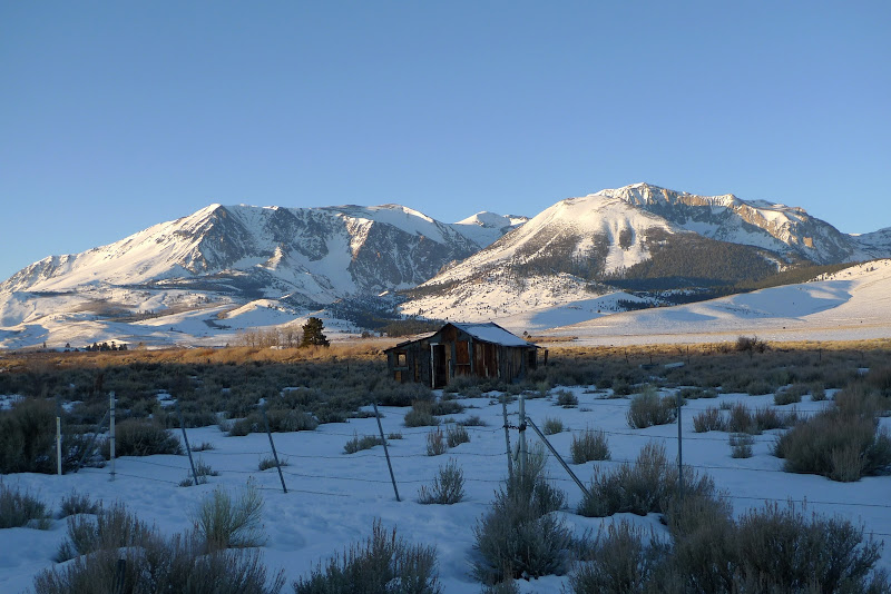
I love the drive along 395, to see the old burnt-out homes back-dropped by the ragged high peaks of the Eastern Sierra.
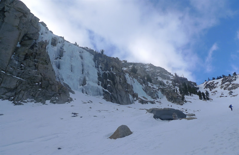
The trail up to Horsetail Falls was in good shape, with the cog railroad tracks still holding sufficient snow in most spots.
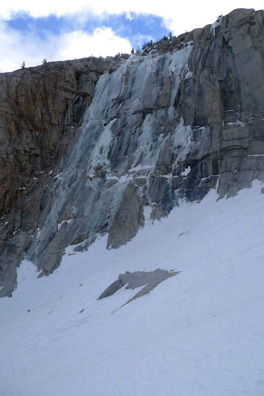
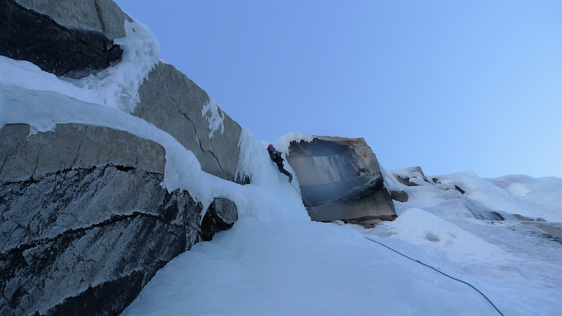
However, as noted in the introduction, Horsetail falls was showing pretty thin ice in spots, with running water on the left-most flow. In fact, the top had been completely burnout by the sun exposure and warm temps from the prior week. Enginerd did manage to lead one fat portion on the right side, which Dynosaur quickly cleaned. However, we decided it was warming too rapidly and just ate some lunch and worked on some ice screw/anchoring techniques around the corner.
Enginerd on the right portion of the thicker section of ice. The running water is to the left out of the picture.
And for the Eastside skiers, here is a beta shot of Dana Plateau during the day on Monday from Enginerd. All of the chutes look very thick at this point (although I am sure they are boilerplate given the melt/freeze conditions. Photo: Enginerd
Looking back towards Mono Lake, with the Eastside and Mammoth area in the distance. Photo: Enginerd
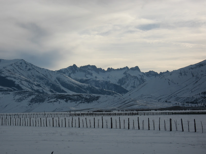
Final beta shot of the Sawtooth sub-range outside of Bridgeport, with the Matterhorn marking the highpoint on the ridgeline. I skied the East Couloir on that two seasons ago with AKBruin. Photo: Enginerd
Last edited by Unfrozen Caveman Lawyer; 01-25-2011 at 08:30 PM.
-
01-25-2011, 03:57 PM #43
 Wax on, scrape off ...
- Join Date
- Mar 2007
- Location
- Eugenio Oregón
- Posts
- 8,858
sweet writeup dude!
(it's spelled dynosaur)_______________________________________________
"Strapping myself to a sitski built with 30lb of metal and fibreglass then trying to water ski in it sounds like a stupid idea to me.
I'll be there." ... Andy Campbell
-
01-25-2011, 04:30 PM #44
 Registered User
- Join Date
- Jan 2006
- Location
- Alpine Meadows, CA
- Posts
- 4,461
Great TR UCL.
**
I'm a cougar, not a MILF! I have to protect my rep! - bklyn
In any case, if you're ever really in this situation make sure you at least bargain in a couple of fluffers.
-snowsprite
-
01-25-2011, 04:37 PM #45
sick, spiteful, bad liver
- Join Date
- Nov 2005
- Location
- underground
- Posts
- 935
I just had a nice day on Mt. Tom, a gully on the SE side, approached from teh Bmilk parking area. Great corn on an aesthetic but mellow line. A couple in the party went on to the summit, but I took it easy and headed down when the snow got hard. Some folks recently had a good time on Split as well, though some folks on birch had hard snow due to high clouds. You should be able to find something worth doing. Originally Posted by harpo-the-skier
-
01-25-2011, 05:34 PM #46
 Registered User
- Join Date
- Dec 2006
- Location
- 37N 122W
- Posts
- 666
When the snow's too firm to ski, GO ICE CLIMBING! Nice TR UCL. Love the video.
"Kids today, all they talk about is big air. I say, stay on the mountain, that's where the action is. If you want big air, pull my finger." ~Smooth Johnson~
-
01-25-2011, 06:19 PM #47
 I'm a Registered User
- Join Date
- Dec 2008
- Posts
- 1,069
would you think these conditions will change in the next few days? It is starting to corn up high around tahoe.
i need to learn how to ice climb... Originally Posted by leroy jenkins
-
01-25-2011, 07:14 PM #48
Registered User
- Join Date
- Jun 2006
- Location
- Pleasuretown
- Posts
- 1,095
That old house always reminds me of the Salomon ad shot there: "Place looks a whole lot better with the new boards." (or something like that).
-
01-25-2011, 07:41 PM #49
Banned
- Join Date
- Jan 2009
- Location
- Reno
- Posts
- 1,344
Hmmm, did the Split party ride the south face and was it soft? Fri/Sat are looking pretty warm up high down there with little wind. What elevation did the snow get hard on Tom? I'm thinking of trying something S facing since this may be the best window for softness there's been. Guess the only way to find out is to go down, start climbing, and gamble! Originally Posted by ms ann thrope
-
01-25-2011, 07:58 PM #50
sick, spiteful, bad liver
- Join Date
- Nov 2005
- Location
- underground
- Posts
- 935
I don't know enough about Split (or the people who skied it) to answer your question . . . they posted a photo of Cardinal, but that could have been from the approach. Originally Posted by BGnight
Snow on Tom started to soften up about 9am; I turned around about 11k feet when I ran out of corn.
http://s904.photobucket.com/albums/ac244/inthepines/
south-facing seems to be the way to go . . . even thin cloud cover or breeze keeps the corn from forming.

 Reply With Quote
Bookmarks